Project Category: Planning

Project Details

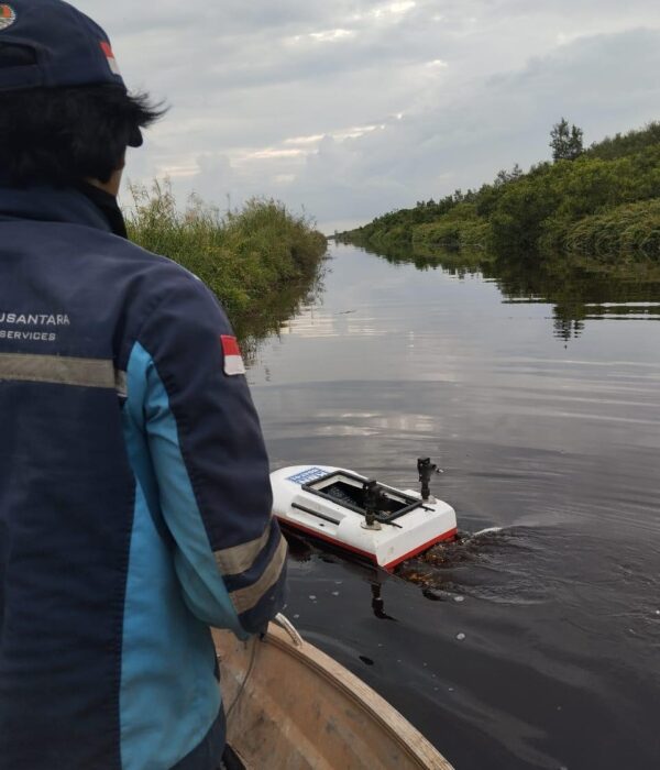
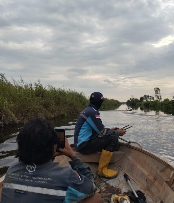
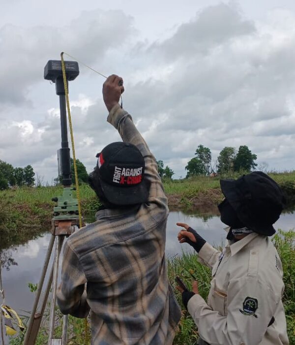
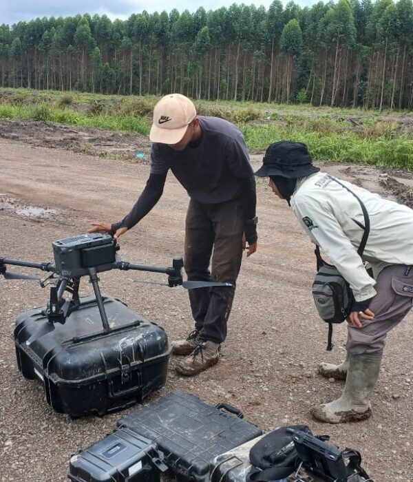
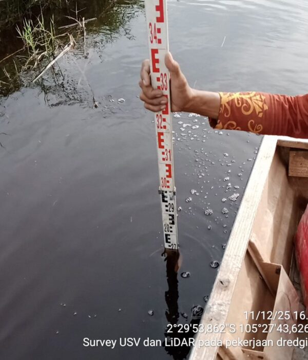
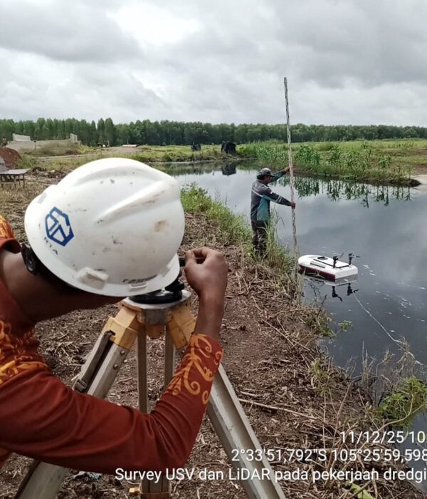
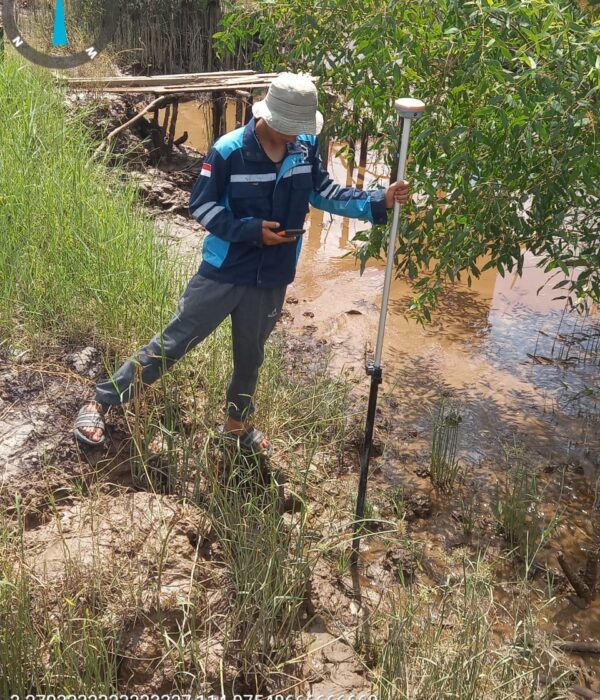
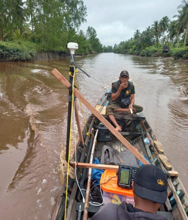
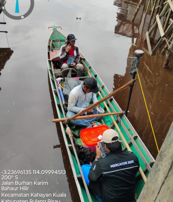
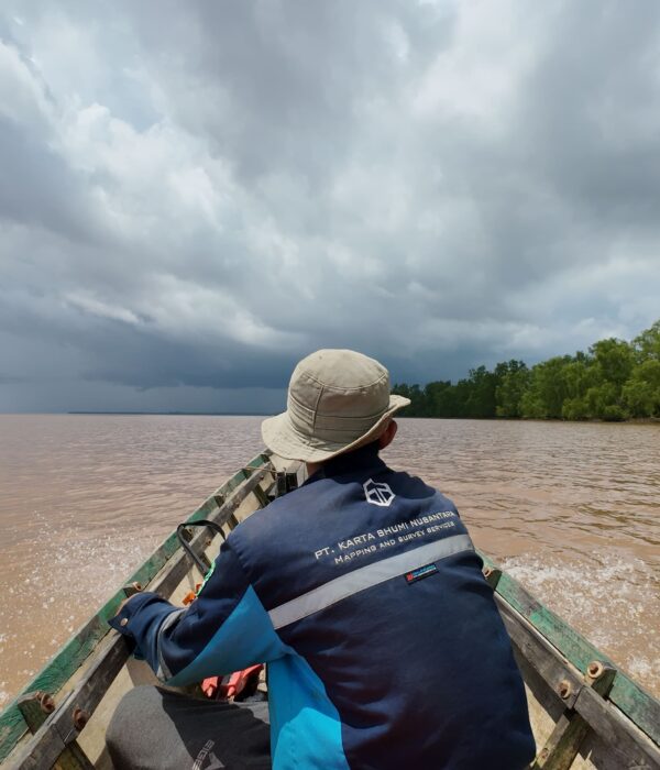
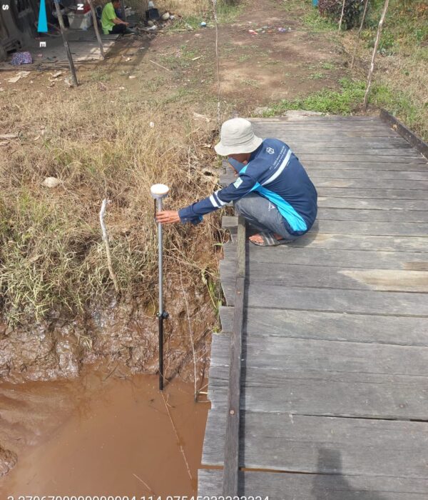
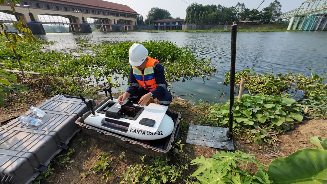
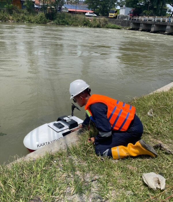
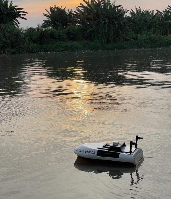
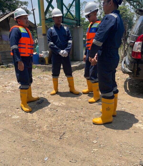
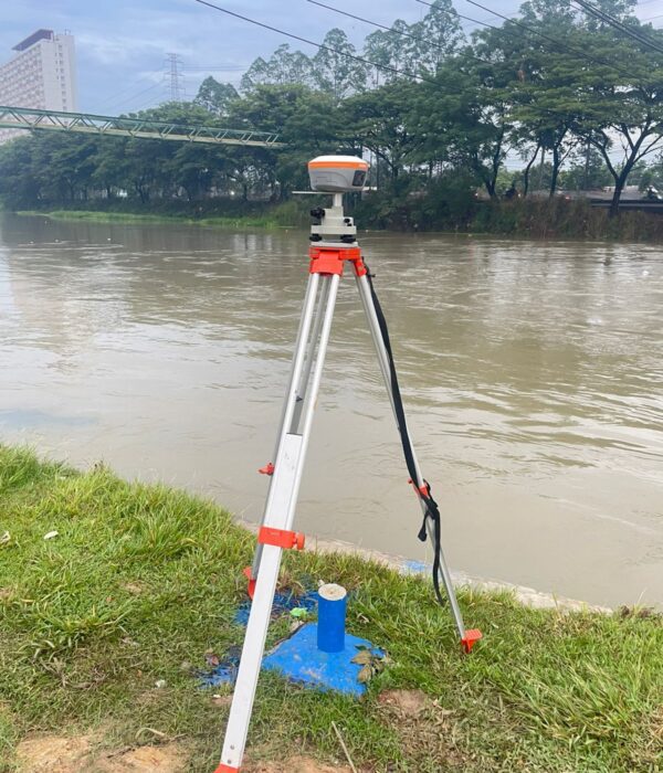
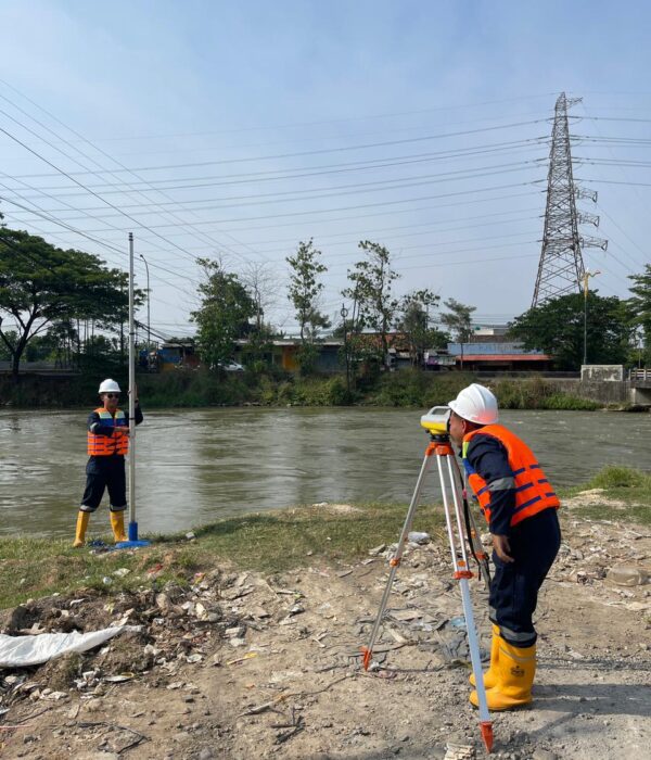
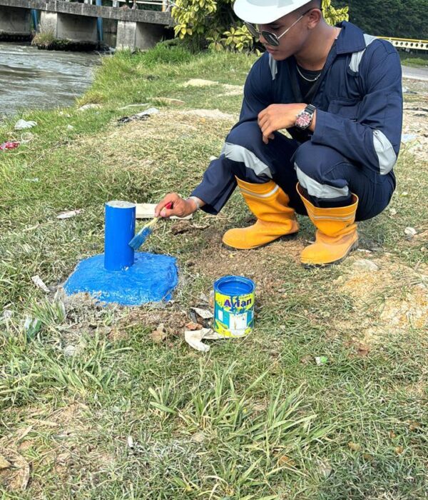
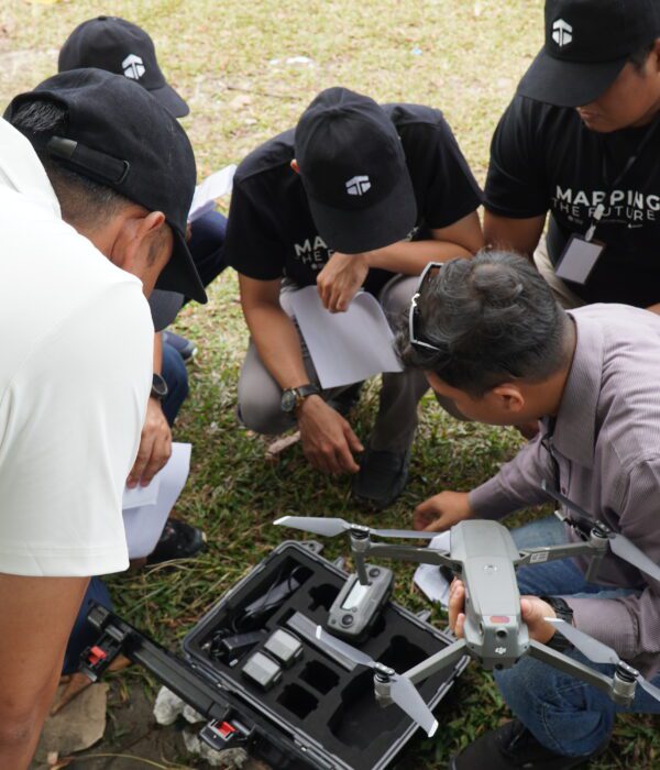
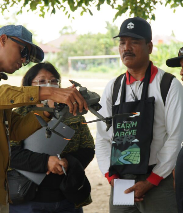
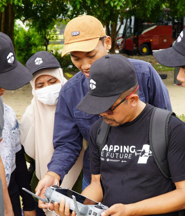
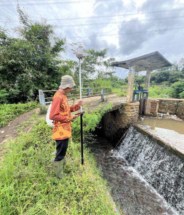
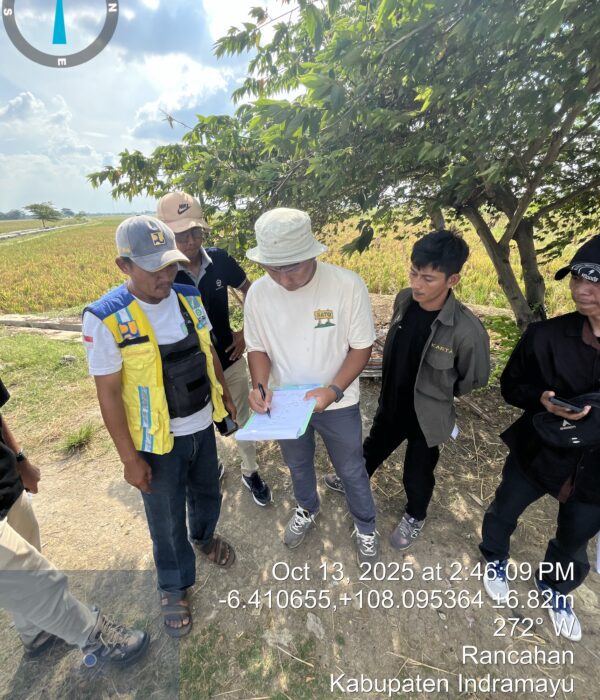
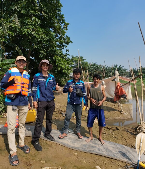
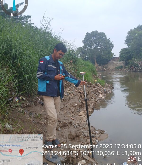
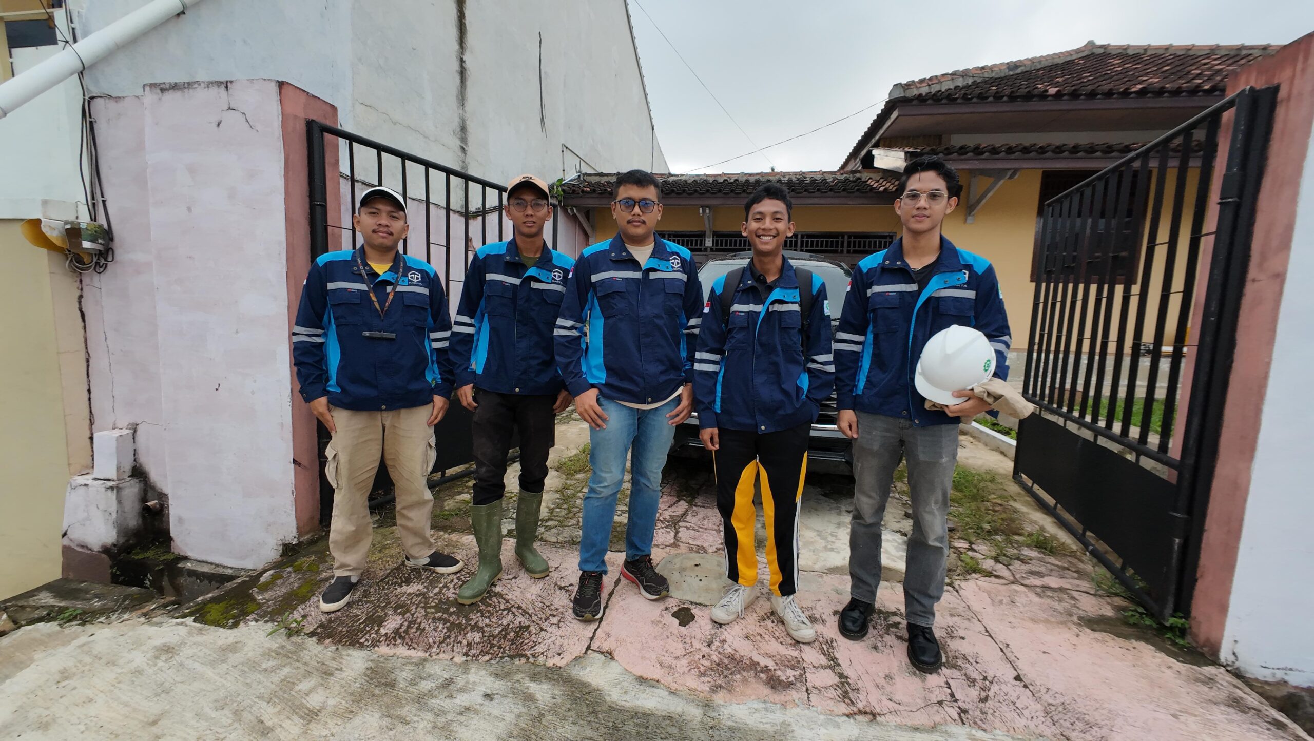
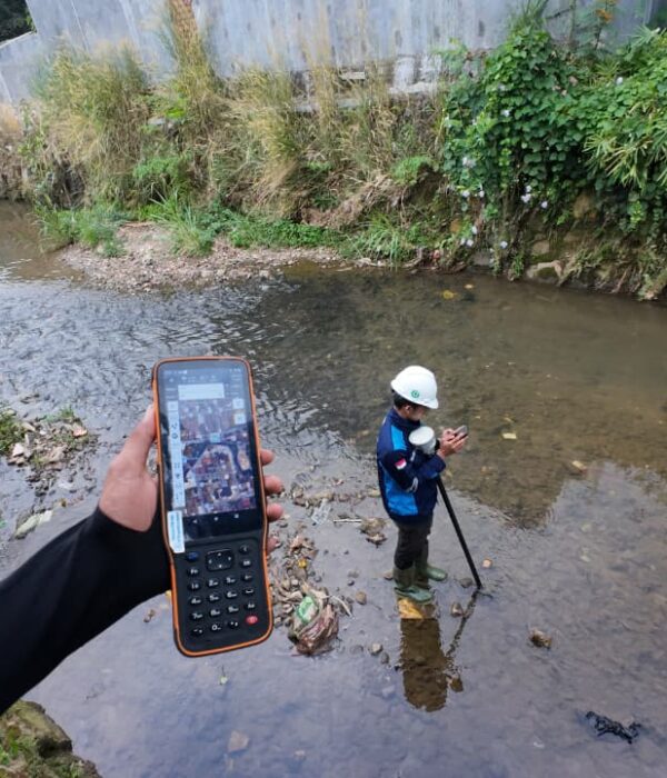
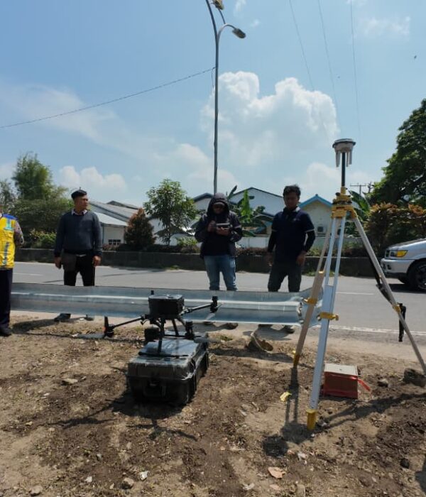
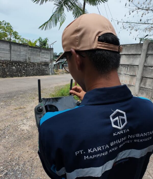
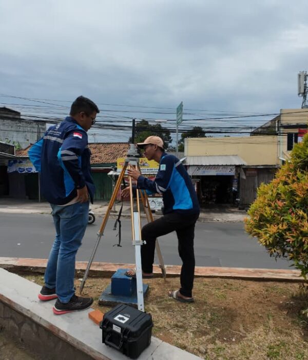
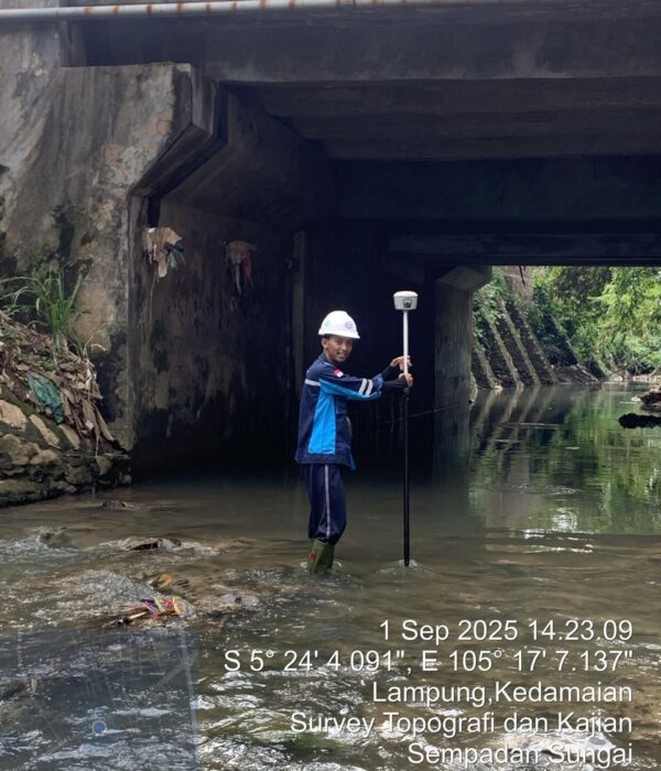
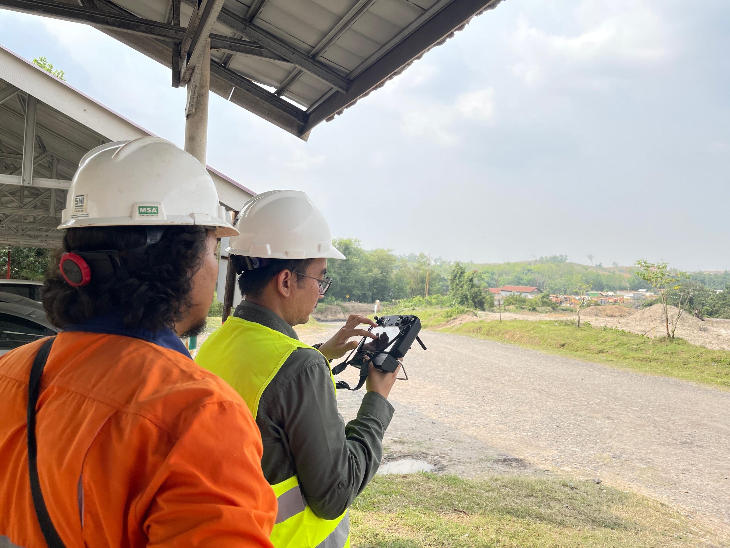
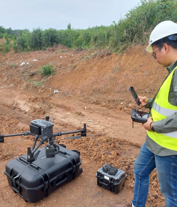
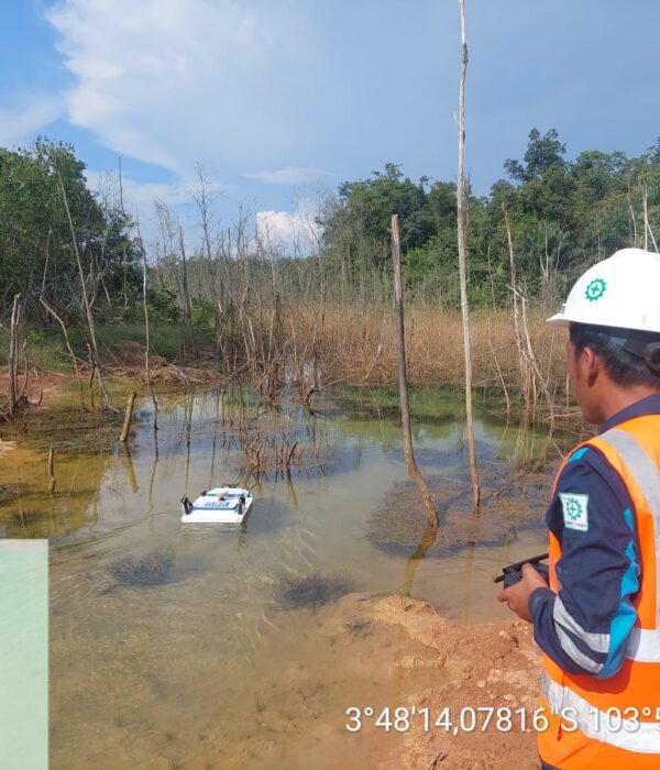
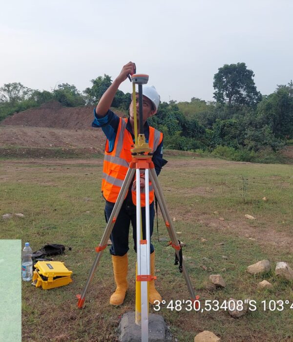
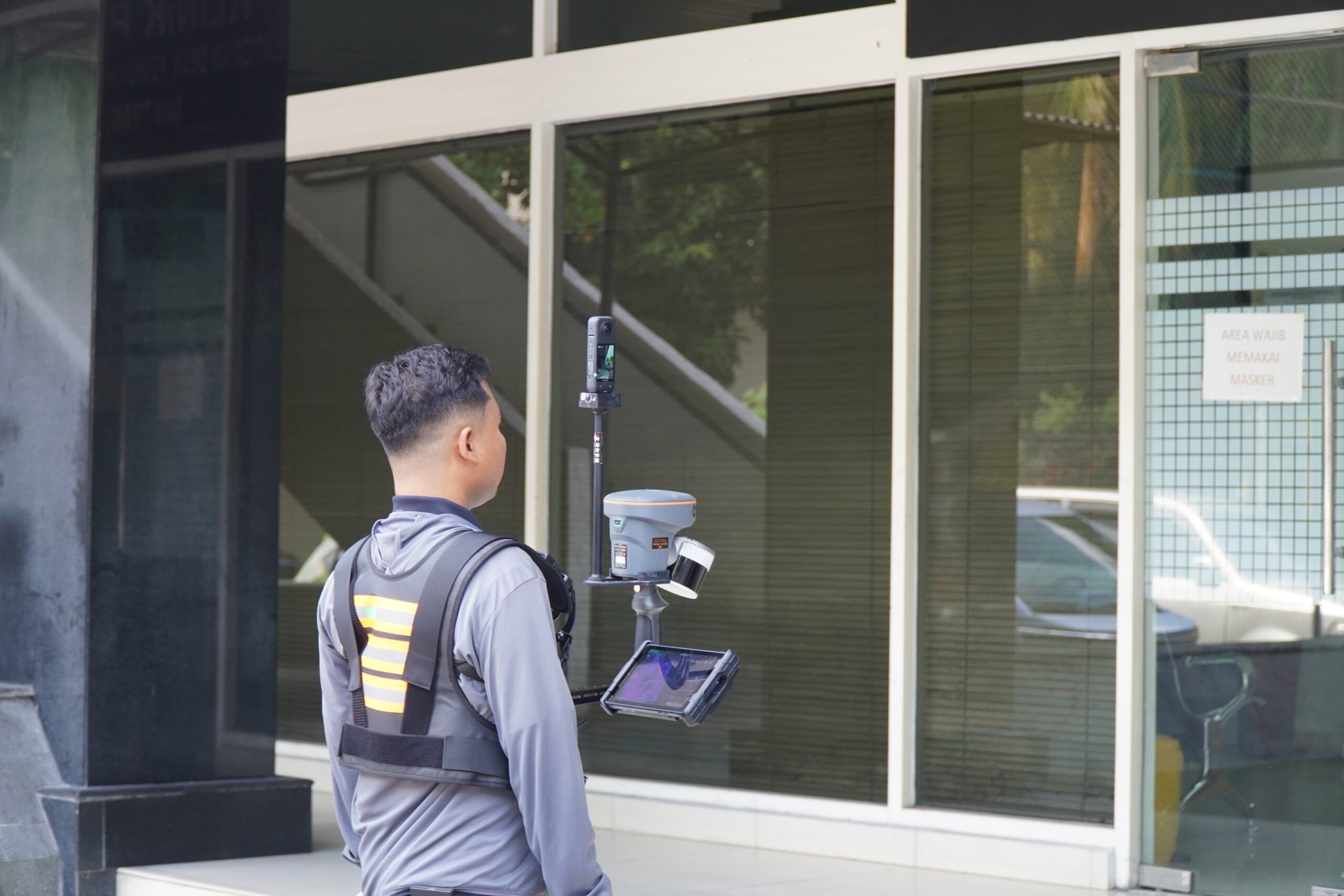
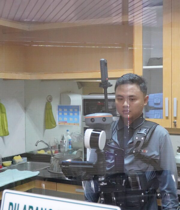
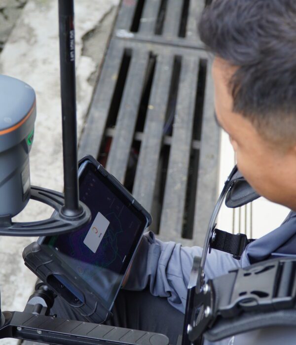
PT Karta Bhumi Nusantara conducted an integrated UAV LiDAR and USV bathymetry survey on the wastewater canal in OKI to produce 1 m contour maps, DTM, long–cross sections, and existing volume calculations as a basis for evaluating capacity and indicating sedimentation.

Project Name
UAV LiDAR Survey and USV Bathymetric Survey for Sewage Canal
Category
Hidrografi,Planning

Project Summery

Wastewater canal management in industrial areas requires accurate, detailed, and up-to-date data—not only to observe surface conditions, but also to understand the basic profile of the canal, which determines its storage capacity, flow smoothness, and potential for silting. To address this need, PT Karta Bhumi Nusantara conducted an integrated survey in Ogan Komering Ilir (OKI) Regency, South Sumatra, on wastewater canals that serve as important routes for the disposal system to the final treatment/disposal area.
This project combines two complementary technologies: LiDAR UAVs to map the topography of the embankment and surrounding area in detail and with precision, and bathymetric USVs (Single Beam Echo Sounder/SBES) to record the depth and morphology of the canal bed. The result is not just a map, but a comprehensive 3D representation—from the land surface to the water bottom—that is far more powerful for technical analysis than either method alone.
In the field, accuracy is maintained through the establishment of control points (BM) and the binding of coordinates using static GNSS observations at control points along the canal. For bathymetry, measurements are taken along the planned survey route so that the canal depth profile is consistently readable. Meanwhile, for UAV LiDAR, acquisition is carried out with an adequate overlap scenario, including effective recording mode support to obtain ground surface points even in vegetated areas.
Data processing was carried out rigorously: LiDAR trajectory correction (GNSS–IMU), noise cleaning, ground and non-ground classification, and Digital Terrain Model (DTM) formation. Bathymetric data was corrected to align with the same elevation reference, then combined with the topographic model to form a complete channel model. From this model, the team compiled a 1-meter interval contour map (scale 1:1,000), produced long sections and cross sections (technical scale H 1:100 and V 1:100), and calculated existing volumes based on cross sections to support the evaluation of canal normalization/management requirements.
Through integrated LiDAR–bathymetry surveys, managers obtain a solid data foundation for: assessing current channel capacity, identifying indications of sedimentation/silting, mapping potential channel narrowing, and developing more appropriate follow-up plans—faster, safer, and with less risk of human error in the field.
Main output of the work
-Raw Data UAV LiDAR & USV Bathymetry (softcopy)
-1:1,000 scale map with 1 m contour interval (softcopy)
-Potongan Panjang & Potongan Melintang skala H 1:100, V 1:100 (salinan elektronik)
-Calculation of Existing Volume (softcopy)
-Final Survey Report (softcopy)
If you need mapping of canals, rivers, reservoirs, dams, or other water infrastructure—whether for capacity assessment, sedimentation monitoring, or normalization planning—PT Karta Bhumi Nusantara is ready to assist with modern, measurable, and accountable survey methods.
Let’s collaborate. Contact us to discuss your survey needs and get the right data from the start.
#UAVLidar #Bathymetry #USVSurvey #SingleBeamEchoSounder #SurveyDanPemetaan #Topografi #DTM #Kontur1Meter #CrossSection #LongSection #VolumeCalculation #GeospatialData #KanalLimbah #OKI #SumateraSelatan #PTKartaBhumiNusantara #JasaSurveiPemetaan

Project Details

Integrated Topographic & Bathymetric Survey by PT Karta Bhumi Nusantara for DIR Kuin & DIR Bahaur, Palangkaraya (±5,000 ha)—combining GNSS control, UAV photogrammetry, and SBES bathymetry to deliver high-resolution orthophotos, DTM, contours, and cross-sections for irrigation planning and rehabilitation.

Project Name
Topographic & Bathymetric Survey for Tidal Swamp Irrigation Areas (DIR Kuin & DIR Bahaur) – Palangkaraya, Central Kalimantan
Category
Hidrografi,Planning

Project Summery

Managing tidal swamp irrigation is never straightforward. Water levels fluctuate with the tides, access can be limited by shallow water and dense vegetation, and soft ground conditions often make conventional land-only surveying inefficient. To support better planning and rehabilitation of irrigation networks, PT Karta Bhumi Nusantara carried out an integrated topographic and bathymetric survey across DIR Kuin and DIR Bahaur in Palangkaraya, Central Kalimantan—covering approximately ±5,000 hectares.
This project delivered accurate, high-resolution spatial data to help stakeholders evaluate existing conditions, analyze channel capacity, identify sedimentation patterns, and plan improvement works with confidence.
Project Objectives
The primary goal of this survey was to obtain reliable existing-condition data for swamp irrigation canals and surrounding terrain by combining:
-RTK GNSS for land features (embankments, canal edges, structures, access points)
-SBES bathymetry to map canal depths and underwater morphology
-UAV photogrammetry to produce high-resolution orthophotos and terrain models
This integrated approach ensures both surface elevation and channel depth are captured comprehensively critical for swamp irrigation environments where much of the system is permanently inundated.
To ensure strong positional accuracy, the project began with establishing a geodetic control framework through Bench Marks (BM) and Control Points (CP) across both DIRs.
Control measurements were conducted using GNSS static differential observations for 1 hour per BM/CP, with one BM in each DIR directly tied to the nearest CORS station DIR Kuin to CORS CKTT and DIR Bahaur to CORS CBJM using a 7-hour session to strengthen network reliability. All coordinates were processed in the SRGI2013 reference system with EGM2008 vertical datum, and transformed to UTM Zone 49S (DIR Kuin) and UTM Zone 50S (DIR Bahaur) for engineering-ready mapping.
Field acquisition combined UAV photogrammetry, RTK GNSS detail measurements, and bathymetry for a complete “land-to-water” model. A DJI Mavic 3E was used to generate high-detail orthophotos and a Digital Terrain Model (DTM), while bathymetric data was collected using a USV equipped with a Garmin 585Plus Single Beam Echo Sounder (SBES), calibrated with barcheck and sensor draft measurements before acquisition.
The final deliverables include orthophotos (~7–10 cm/pixel detail), an integrated DTM, a 1:1,000 contour situation map with 0.5 m contour interval, and long & cross sections every 50 meters, along with raw datasets, a BM/CP description book, and the final technical report—a complete foundation for precise analysis, design, and future monitoring in tidal swamp irrigation systems.
Ready to move from assumptions to accurate, actionable data? 
PT Karta Bhumi Nusantara is prepared to support your irrigation, water management, and infrastructure projects with reliable topographic and bathymetric surveying delivered with clear outputs and engineering-ready references. 
Let’s collaborate. Contact us to discuss your survey needs and get the right data from the start.
#TopographicSurvey #BathymetricSurvey #HydrographicSurvey #SwampIrrigation #IrrigationSurvey #WaterResources #Geospatial #SurveyingAndMapping #UAVMapping #DroneMapping #Photogrammetry #GNSS #RTK #PPK #DTM #Orthophoto #EngineeringSurvey #InfrastructureMapping #CentralKalimantan #Palangkaraya #jasasurveipemetaan #JasaSureiPemetaan #JasaSurveiIndonesia #Kartabhuminusantara

Project Details

Discover what lies beneath the water surface. Karta Bhumi conducted a bathymetric survey for the Cikampek–Plumpang BBM pipeline crossings in West Java, using GNSS control, RTK mapping, and a USV-equipped single beam echosounder to deliver accurate DTM, contours, and cross-sections for engineering-ready planning.

Project Name
Bathymetric Survey for the Cikampek–Plumpang Fuel Pipeline Crossings in West Java
Category
Hidrografi,Planning

Project Summery

When a pipeline route meets a river or a canal, the real story isn’t only on land—it’s under the water surface.
For the Cikampek–Plumpang BBM (fuel) pipeline corridor in West Java, Karta Bhumi carried out a bathymetric survey to capture what can’t be seen by the naked eye: the underwater terrain (riverbed/canal bed), depth variations, and channel geometry at key crossing points. This underwater “map” becomes a practical foundation for safer, smarter, and more efficient engineering design.
Survey Coverage
This work focused on four key waterway crossings in West Java:
-KP 11+200 – Walahar River
-KP 41+500 – West Tarum Main Canal (Saluran Induk Tarum Barat)
-KP 71+100 – CBL Canal (Cikarang Bekasi Laut)
-KP 81+400 – East Flood Canal (Banjir Kanal Timur / BKT) 
How We Collected the Data
To keep the results accurate and engineering-ready, the survey combined:
-Static GNSS control points for a strong reference system (UTM 48S / SRGI 2013 / EGM2008)
-RTK GNSS topography to map canal/river banks and nearby features
-USV + Single Beam Echo Sounder (SBES) to measure depths efficiently and safely, including calibration and corrections (barcheck, draft, and water level adjustment).
What We Delivered (Engineering-Ready Outputs)
Instead of just “depth numbers,” the survey outputs were prepared for practical design use:
-DTM (Digital Terrain Model) combining topography + bathymetry
-Contour maps at 1:1,000 scale with 0.5 m contour interval
-Long section (longitudinal profile)
-Cross sections every 5 meters across the channel 
These deliverables help engineering teams visualize the crossing clearly—almost like “seeing” the riverbed without diving.
With accurate bathymetric data, pipeline crossing design becomes more than an assumption—it becomes a decision backed by real measurements. Karta Bhumi is ready to support your infrastructure and industrial projects with reliable GNSS, topographic, and bathymetric surveys, delivering outputs that are clear, engineering-ready, and easy to use.
Let’s collaborate. Contact us to discuss your survey needs and get the right data from the start.
#KartaBhumi #BathymetrySurvey #SurveiBatimetri #PipelineCrossing #BBMPipeline #USVSurvey #EchoSounder #SingleBeamEchosounder #RTKGNSS #GNSSSurvey #TopographicSurvey #Geospatial #Mapping #DTM #Surveying #CivilEngineering #Infrastructure #WestJava #JasaSureiPemetaan #JasaSurveiIndonesia
Volumetric Analysis: Calculating stockpile volumes and land changes with high precision.

Project Details

PT Karta Bhumi Nusantara (PT KBN) successfully implemented a strategic project to determine and confirm village boundaries (PPBW) covering 24 districts throughout the Raja Ampat Regency. This large-scale project involved determining and confirming the boundaries of 117 villages and 4 sub-districts, prioritizing a collaborative approach and data accuracy.

Project Name
Determination & Confirmation Territorial Boundaries of the Raja Ampat Regional Government
Category
Geospasial,GIS,Planning

Project Summery

PT Karta Bhumi Nusantara (PT KBN) carried out the Village Boundary Delineation and Demarcation (PPBW) project across 24 districts in Raja Ampat Regency, covering 117 villages and 4 urban wards (kelurahan). The process involved the collection of historical boundary data and boundary delineation for each village, conducted in close coordination with district heads and village leaders.
Boundary map verification was carried out with the support of the Geospatial Information Agency / Badan Informasi Geospasial (BIG) 
Boundary map verification was carried out with the support of the Geospatial Information Agency / Badan Informasi Geospasial (BIG) to ensure compliance with national technical specifications and applicable regulations.
The Importance and the purpose
Village boundary mapping is essential to ensure that no administrative areas overlap or fall outside any village jurisdiction
Village boundary maps are legally required for every village in Indonesia under national regulations. In addition, these maps are a mandatory prerequisite for:
-Regional expansion proposals
-Preparation of Detailed Spatial Plans (RDTR)
-Land administration and development planning
-Resolution of administrative and territorial disputes
Historical Data Collection & goverment outreach
The local government collected historical boundary data supported by legal documents as the foundation for boundary tracing and confirmation. These historical records became the primary reference in the preparation of village boundary maps.To strengthen institutional understanding, BIG conducted boundary mapping socialization activities for local governments, emphasizing the importance and urgency of standardized village boundary maps.
Cartometric Boundary Delineation
Cartometric boundary delineation was carried out by the KBN team based on stakeholder testimony and verified historical data. The process utilized high-resolution satellite imagery, applying cartometric digitization techniques to accurately trace village boundaries.
Data Standardization & Validation
The digitized boundary data were standardized in accordance with village mapping regulations.Spatial data processing was conducted using GIS software, followed by data confirmation with respective village governments and neighboring districts. Topology checks were applied to ensure spatial accuracy and consistency.
Technical Verification by BIG
Technical verification by BIG was conducted to ensure the village boundary maps met all national technical standards. Any identified issues were corrected by the KBN team until the maps were officially declared compliant. To date, 39 villages and 4 urban wards have successfully passed BIG’s technical verification.
The Next STep
Village boundary maps that passed technical verification were then compiled into a Regent Decree Map as an attachment to the Regent Regulation. KBN prepared the official documentation (minutes of agreement), which was subsequently endorsed by village and district officials before proceeding to final verification by the Ministry of Home Affairs.
Our commitment is to provide spatial accuracy for the resolution of land disputes and better development planning
Volumetric Analysis: Calculating stockpile volumes and land changes with high precision.

Project Details

In a strategic collaboration with the Ministry of Environment and Forestry (KLHK) and Artabhumi, our team of expert consultants provided comprehensive mentorship in advanced photogrammetry, high-precision GCP (Ground Control Point) deployment, and complex volumetric data analysis. This initiative was designed to empower ministry personnel with the spatial intelligence necessary for the sustainable management and real-time monitoring of Sumatra’s vital forest ecosystems.

Project Name
Advancing Environmental Monitoring: Karta Bhumi Nusantara & Artabhumi Empower KLHK with Drone Technology in Pekanbaru
Category
Planning

Project Summery

Pekanbaru, Sumatra – In an era where environmental data precision is paramount, Karta Bhumi Nusantara, a leading Spatial & Environmental Mapping Consultancy, successfully conducted an intensive technical training program for the Ministry of Environment and Forestry (KLHK) personnel.
In strategic partnership with Artabhumi, the program held in mid-November 2025 in Pekanbaru marks a significant milestone in integrating photogrammetry technology for the monitoring of forest areas and environmental conservation throughout the Sumatra region.
Karta Bhumi Nusantara: Beyond Training, We Deliver Consulting Excellence
As a specialized consultancy, Karta Bhumi Nusantara recognizes that aerial imagery is only as valuable as its accuracy. During this collaboration with KLHK, Karta Bhumi Nusantara implemented high-tier consulting standards, ensuring every participant could produce data that is both scientifically valid and legally accountable.
"Our mission extends beyond teaching drone flight; we provide a consulting methodology that transforms raw data into actionable spatial intelligence," stated the expert team from Karta Bhumi Nusantara.
Strategic Program Highlights: Professional Consulting Standards
The three-day curriculum was systematically designed to cover all operational and managerial aspects of modern mapping:
1. Theoretical Foundation & Legal Compliance (Day 1)
The session commenced with a deep dive into photogrammetry theory and the drone ecosystem for environmental use. As a law-abiding consultancy, Karta Bhumi Nusantara placed heavy emphasis on:
-UAV Regulations: Ensuring all KLHK drone operations comply with Indonesian airspace authorities.
-Safety Management: Implementing Work Health and Safety (WHS/K3) protocols to mitigate field risks.. 
-Flight Planning: Strategic mission planning for efficient data acquisition over vast terrains.
2. Field Implementation & GCP Precision (Day 2)
Theory was put into practice as participants mobilized to the field. Under the guidance of Artabhumi instructors and Karta Bhumi consultants, participants executed:
-GCP (Ground Control Point) Deployment: A crucial consulting technique emphasized by Karta Bhumi to ensure high-precision georeferencing.
-Pre-flight & Emergency Procedures: Establishing SOPs to safeguard high-value hardware assets.
-Data Acquisition: Capturing high-resolution aerial data optimized for advanced processing.
3. Advanced Data Processing & Volumetric Analysis (Day 3)
The final stage showcased Karta Bhumi Nusantara’s core expertise in data analytics. Participants were mentored in:
-Orthophoto Processing: Converting raw images into detailed, measurable digital maps.
-Volumetric Analysis: Calculating stockpile volumes and land changes with high precision.
-Visualization & Reporting: Communicating spatial data effectively to support KLHK’s policy-making.
Does your agency or company require accurate and professional mapping solutions? Karta Bhumi Nusantara is ready to be your strategic partner in providing mapping consultancy and drone training across Indonesia.
#KartaBhumiNusantara #MappingConsultant #EnvironmentalConsultancy #DroneSurvey #Photogrammetry #SpatialIntelligence #KLHK #PekanbaruProject #UAVMapping #GeospatialSolutions #ForestryMonitoring #VolumetricAnalysis #JasaSurveiLiDAR

Project Details

PT. Karta Bhumi Nusantara has successfully completed a comprehensive topographic survey to support the Land Optimization Program (OPLAH) in West Java Province. In collaboration with the Ministry of Public Works and Housing (PUPR), our team conducted a massive mapping operation across 21 Irrigation Areas.

Project Name
Topographic Survey for Irrigation Land Optimization in West Java
Category
Planning

Project Summery

Topographic Survey for Irrigation Land Optimization in West Java
We are thrilled to share the successful completion of our Topographic Survey Project aimed at optimizing land and irrigation networks across West Java Province. Carried out by PT. Karta Bhumi Nusantara, this initiative is a vital step in supporting Indonesia’s national food security through reliable infrastructure.
What We Did 🔍
Our team embarked on a comprehensive mission to capture high-precision geospatial data across four key regencies: Brebes, Garut, Kuningan, and Indramayu. Covering a total area of over 41.6 kilometers, we focused on detailed mapping of 21 Irrigation Areas (D.I.) to provide the foundation for future renovations and improvements.
To ensure the highest accuracy, we utilized cutting-edge RTK GNSS (Real Time Kinematic) technology. This allowed us to achieve horizontal precision of ±1–2 cm and vertical precision of ±2–3 cm in real-time. From establishing permanent Bench Marks (BM) to creating detailed 1:1,000 scale contour maps, every step was executed with technical excellence
What We Discovered on the Ground?
Comprehensive Data: We produced detailed Long & Cross Sections every 50 meters to analyze canal geometry and water flow efficiency.
Diverse Conditions: Our survey identified a mix of modern concrete canals and traditional earth-based channels, highlighting specific areas that need rehabilitation to prevent water loss.
Sustainable Impact: By identifying leaks, damaged embankments, and sedimentation, our data provides a clear roadmap for the Ministry of Public Works and Housing (PUPR) to optimize water distribution to farmers.
Final Deliverables 📋
We have successfully handed over a complete package of digital assets, including raw geospatial data, high-accuracy Bench Mark (BM) records, and detailed 1:1,000 scale contour maps. 
 Why Is This Project  Important?
Reliable irrigation is the backbone of agriculture. This survey isn't just about collecting numbers; it’s about revitalizing our food source. By providing high-precision mapping, we enable the government to:
- Maximize Land Potential: Transform underutilized areas into productive farmland through the Land Optimization Program (OPLAH).
- Water Efficiency: Ensure that every drop of water from the source reaches the rice fields without being lost to leaks or poor drainage.
- Resilient Infrastructure: Provide the exact data needed to repair aging canals, preventing floods during the rainy season and droughts during the dry season.
We are proud to contribute to a more sustainable and productive agricultural future in West Java!
💡 Want to learn more about our geospatial solutions? Stay tuned for more project updates!
#TopographicSurvey #Geospatial #CivilEngineering #IrrigationSystem #LandOptimization #SmartFarming #PrecisionMapping #InfrastructureDevelopment #WestJavaProject #NationalFoodSecurity #GNSSRTK #EngineeringExcellence

Project Details

PT. Karta Bhumi Nusantara once again collaborated with the Ciliwung-Cisadane River Basin Management Agency (BBWS) to study the Bekasi River boundaries. Using UAV photogrammetry, GNSS RTK (Remote-Called Navigation), and bathymetry technology, the PT Karta Bhumi Nusantara team mapped approximately 34 km of the Bekasi River to precisely identify the river boundaries.

Project Name
Topographic Survey for Bekasi River Study
Category
Planning

Project Summery

Topographic Survey for the Kali Bekasi River Boundaries, Bekasi
Who would have thought that beneath the bustling traffic of Bekasi City lies a large river that serves as the lifeblood of the city's flood control system? This river not only channels rainwater and surface runoff, but also plays a vital role in the ecological system, maintaining environmental balance.
Unfortunately, the increasing density of development along the riverbanks has blurred the boundaries of the Bekasi River. Many buildings are standing too close, green spaces are shrinking, and water flow capacity is decreasing. As a result, the risk of flooding increases year after year.
So, how can we re-manage river spaces to keep them safe, functional, and sustainable?
The answer: seeing rivers from the air using modern geospatial technology
 🛰️ Seeing Rivers with Centimeter Accuracy
Imagine:
- A drone flies low over the river, capturing thousands of high-resolution (5 cm/pixel) photos.
- A sonar instrument on an unmanned watercraft (USV) measures the depth of the riverbed with centimeter accuracy.
- Meanwhile, a GNSS instrument on land determines the position and elevation of each point with geodetic precision.
All this data is combined in processing software. The result? Not just a map, but a realistic picture of the current condition of the river and its banks, which can serve as a scientific basis for smarter urban spatial planning. This includes high-resolution (5 cm/pixel) orthophoto data, 0.5 m contour maps, and detailed river cross-sectional profiles, all of which serve as the basis for spatial planning of river boundaries and flood mitigation in the Bekasi area.
🌱 Data Speaks: From Images to Policy
The data generated from this survey is incredibly rich in information.Orthophoto maps with a resolution of 5 cm/pixel can clearly show buildings that are too close to the river, changes in riverbank lines, and even lost vegetation. From the DTM and cross-sections, planners can analyze the potential for flooding during the rainy season and identify critical points that need reinforcement or restoration.
💡 Why Is This Important for Cities and Residents?
- Maintaining riverbanks is not just the government's responsibility, but a matter for all of us
- When river boundaries are properly defined, flooding can be controlled because water has room to flow freely.
- Environmental quality improves because natural vegetation along the boundaries acts as a natural filter.
- Communities are safer because they no longer live in high-risk zones.
- City planning is more efficient because it is based on valid and up-to-date spatial data.
This project also demonstrates that innovative geospatial technology can help maintain a balance between development and environmental sustainability. This technology not only produces maps but also presents a new direction in environmental management based on spatial data.
#KartaBhumiNusantara #UAVLiDAR #Photogrammetry #Bathymetry #RiverBorder #KaliBekasi #BBWSCiliwungCisadane #Topography #GeospatialIndonesia #SurveyDrone #EnvironmentalMapping #BuildWithPrecision

Project Details

PT Karta Bhumi Nusantara and its team have completed a topographic survey of the Way Garuntang and Way Balau Rivers in Bandar Lampung City, Lampung Province. This survey was conducted using UAV LiDAR for detailed elevation mapping and GNSS RTK for determining ground control points and validating data accuracy.

Project Name
Topographic Survey for the Way Garuntang and Way Balau River Boundaries, Lampung
Category
Planning

Project Summery

Topographic Survey for the Way Garuntang and Way Balau River Boundaries, Lampung
PT Karta Bhumi Nusantara, along with its implementing team, successfully completed a topographic survey of the Way Garuntang and Way Balau River boundaries in Bandar Lampung City, Lampung Province. This survey was conducted to obtain high-precision spatial data that can be used as a basis for determining river boundaries along approximately 26.9 km. Given the river's location across an urban area with a relatively high population density, this survey plays a crucial role in the development of spatial planning policies, flood control, and the protection of protected areas along the riverbanks.
The methodology applied in this survey utilized UAV LiDAR technology for detailed elevation data acquisition and GNSS RTK for ground control point (GCP) measurements, which serve to bind and validate the LiDAR data. The combination of these two methods resulted in the acquisition of precise topographic data, both in the form of 0.5-meter interval contours and digital surface models (DSMs) and digital elevation models (DEMs). The advantage of UAV LiDAR is that it allows for dense vegetation penetration along riverbanks, allowing for a clearer understanding of the underlying morphology of the land.
The mapping scope not only focuses on the main river channel but also includes the banks on both sides of the river, which are included in the riparian area. The data obtained is used to produce detailed topographic maps, cross-sections at specific intervals, and long sections along the river alignment. This information is crucial for identifying changes in river channel geometry, potential erosion, critical landslide points, and areas prone to flooding. Thus, the survey results provide a comprehensive picture of the existing condition of the river and surrounding land.
The main problem faced in this area is the high pressure of human activities along the riverbanks, ranging from settlements and economic activities to waste disposal. This often leads to flooding, siltation, and reduced environmental quality. With this survey data, the local government and relevant technical agencies have a strong basis for establishing riparian lines in accordance with regulations and developing disaster mitigation programs based on current data.
In addition to technical and environmental aspects, the survey results also contribute to the development of regional medium-term development planning documents (RPJMD), detailed spatial planning plans (RDTR), and flood control master plans in the Bandar Lampung urban area.
With UAV LiDAR and GNSS RTK technology-based solutions, PT Karta Bhumi Nusantara is able to provide accurate, fast, and comprehensive data to support the needs of both the government and the private sector in river management. This work not only produces maps and topographic models but also serves as a crucial instrument in efforts to maintain ecological balance and sustainable development in the Lampung urban area. With valid data, it is hoped that decision-making can be more targeted, effective, and oriented towards environmental sustainability.
#LiDAR #UAVLiDAR #Photogrammetry #PointCloud #GeoSpatial #3DMapping #DroneMapping #Surveying #Mapping #Topography #Consultant #SpatialData #GNSSRTK #GpsGeodetic #MappingConsultant #GIS #GISAnalysis #Forestry #topoghrapicmapping #LongandCrossSection #Countur #MappingSpasial

Project Details

PT Karta Bhumi Nusantara and its team have completed a topographic survey using UAV LiDAR, photogrammetry, and bathymetry in the Muara Enim area of ​​South Sumatra. This activity encompassed mapping approximately 89 hectares of land and approximately 22.5 hectares of river bodies, including the Bangke River, Mbiung River, and Kiahaan River. The survey was conducted to support technical planning, hydrological analysis, and environmental management in the mining concession area.

Project Name
Topographic Survey for mining area – Muara Enim Regency
Category
Planning

Project Summery

Topographic Survey for mining area - Muara Enim Regency
PT Karta Bhumi Nusantara has completed an integrated topographic survey using UAV LiDAR, photogrammetry, and bathymetry in the PT Manambang Muara Enim concession area in South Sumatra. This activity focused on three main rivers: the Bangke River, the Mbiung River, and the Kiahaan River, which have complex morphological characteristics, combining open land, dense vegetation, and river bodies with varying depths.
Monitoring was carried out over approximately 89 hectares of land and approximately 22.5 hectares of river bodies. To obtain accurate data, the team installed control points (CPs) using static GNSS methods, followed by UAV LiDAR and photogrammetry data acquisition. The mapping results produced high-resolution aerial orthophotos with an accuracy of 2 cm per pixel, as well as LiDAR point clouds, which were then classified into ground, vegetation, and other objects.
In addition, bathymetric surveys using a USV equipped with a Garmin 585 Plus Single Beam Echo Sounder (SBES) sensor were conducted in the Mbiung and Kiahaan Rivers, while RTK GNSS methods were used in the Bangke River. The results were a riverbed elevation model, bathymetric maps, and longitudinal and cross-sectional profiles that provide details on depth, width, and bank conditions.
The resulting outputs included orthophoto maps, 0.5 m contour maps, digital elevation models, lengths and cross-sections, and coordinate descriptions of the watershed. All of this data has been integrated into the official coordinate system, allowing for direct use to support technical planning and hydrological modeling.
The survey results also revealed significant changes in the landscape from 2013 to 2024, primarily due to open-pit mining activities around the Bangke and Mbiung Rivers. These changes affected vegetation cover, sedimentation potential, and river hydrological patterns, making this updated spatial data crucial for environmental impact planning and mitigation.
By utilizing UAV LiDAR, RTK GNSS, and USV Bathymetry technology, PT Karta Bhumi Nusantara continues to deliver modern survey solutions that are accurate, efficient, and sustainable. The resulting data serves as a critical foundation for supporting air resource management, risk mitigation, and environmentally conscious infrastructure development in the Muara Enim region.
#LiDAR #UAVLiDAR #Photogrammetry #PointCloud #GeoSpatial #3DMapping #DroneMapping #Surveying #Mapping #Topography #Consultant #SpatialData #MappingConsultant #GIS #GISAnalysis #Forestry #miningmapping #LongandCrossSection #Countur #MappingSpasial

Project Details

PT Karta Bhumi Nusantara conducted a 3D survey of the Makarti Muktitama Building in Jakarta as part of its efforts to provide high-accuracy spatial data for facility management, planning, and infrastructure development. The survey aimed to provide a detailed 3D representation of the building to support asset documentation, renovation planning, and digital transformation in building management.

The survey utilized advanced 3D scanning technology and UAV photogrammetry, enabling the production of precise point clouds, 3D models, and digital twins. The results ensured accurate visualization and measurement of the building structure, supporting stakeholders in data-driven decision-making for efficient design, monitoring, and future development.

Project Name
3D Survey of the Makarti Muktitama Building – Jakarta
Category
Planning

Project Summery

📍 3D Survey of the Makarti Muktitama Building – Jakarta
3D surveys of buildings play a crucial role in recording existing conditions in detail and precision. All elements of the building, from the main structure to architectural details, are documented in the form of accurate three-dimensional models. This data serves as a crucial basis for renovations, technical audits, and long-term asset management.For this activity, the Karta Bhumi Nusantara team used the CHCNAV RS-10 SLAM 3D Laser Scan. Simultaneous Localization and Mapping (SLAM) technology enables GPS-free scanning, ideal for indoor areas or locations with signal obstructions. This process produces a high-resolution point cloud that represents the shape and size of each building element in detail.
The results are then processed into a 3D As-Built Model, which serves as an accurate reference for architects, engineers, and building managers. With this digital documentation, management and decision-making can be data-driven, making them more efficient, cost-effective, and targeted.
#KartaBhumiNusantara #CHCNAV #3DLaserScan #SLAMTechnology #AsBuiltModeling #Surveying #Geospatial #DigitalTwin #BIM #3DModeling #MakartiMuktitamaHall