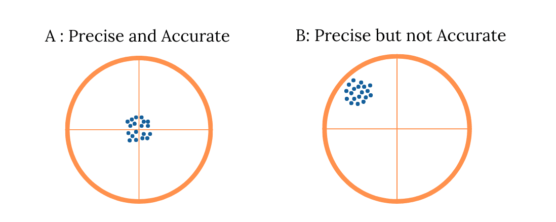
Precision and accuracy are two important concepts in measurement and mapping. Precision refers to the consistency of repeated measurement results, while accuracy indicates how close the results are to the true value. A measurement can be very precise, but it is not necessarily accurate if the resulting value is far from the true value. In the context of surveying and mapping, a combination of high precision and good accuracy is crucial for producing reliable data that can be used in planning and decision-making.

Building Information Modeling (BIM)
Building Information Modeling (BIM) is a technology-based process used to create and manage digital representations of the physical and functional characteristics of a building or infrastructure. BIM is more than just software, but rather an integrated methodology that enables cross-disciplinary collaboration between architects, engineers, contractors, and project owners within a single, integrated digital model.
Precision Navigation on Drone Mapping
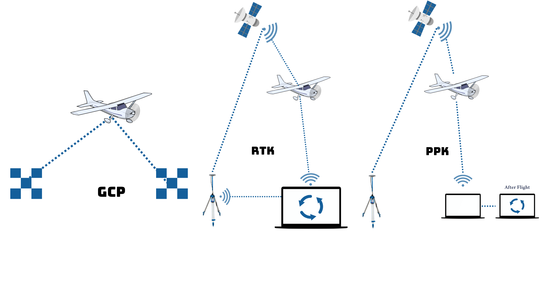
Precision Navigation on Drone Mapping is a high-precision navigation technology used to ensure drones fly accurately on planned paths and positions. With the support of GNSS RTK/PPK systems and other navigation sensors, drones can record the position of each aerial image with centimeter accuracy. This technology is crucial in professional mapping because it produces precise data with minimal distortion, allowing output such as orthophotos, contour maps, and digital elevation models to be directly used for technical needs such as infrastructure planning, engineering design, or spatial analysis. Precision navigation ensures drone mapping is not only fast and efficient, but also highly accurate.

The Importance of Determining Territorial Boundaries for Sustainable Development
In an effort to realize equitable and sustainable development, the determination and confirmation of territorial boundaries is a primary foundation that cannot be ignored. Clear and verified territorial boundaries not only determine the administrative authority of a region, but also form the basis for planning, resource management, and effective public services.