Did you know why drone mapping results are so precise down to the centimeter?
That’s because our drones don’t just “fly and take photos” — they use precision navigation systems, such as GNSS RTK/PPK, to ensure the accuracy of each photo’s position. So, when processed, the orthophotos and contours perfectly match the actual conditions on the ground.
Precision Navigation on Drone Mapping
In the era of modern mapping technology, particularly in the world of surveying and engineering, the use of drones (UAVs) for mapping has become a new standard in efficiency and accuracy. However, how do we ensure that mapping results are truly accurate and reliable? Three main methods are used to ensure geospatial positioning accuracy:
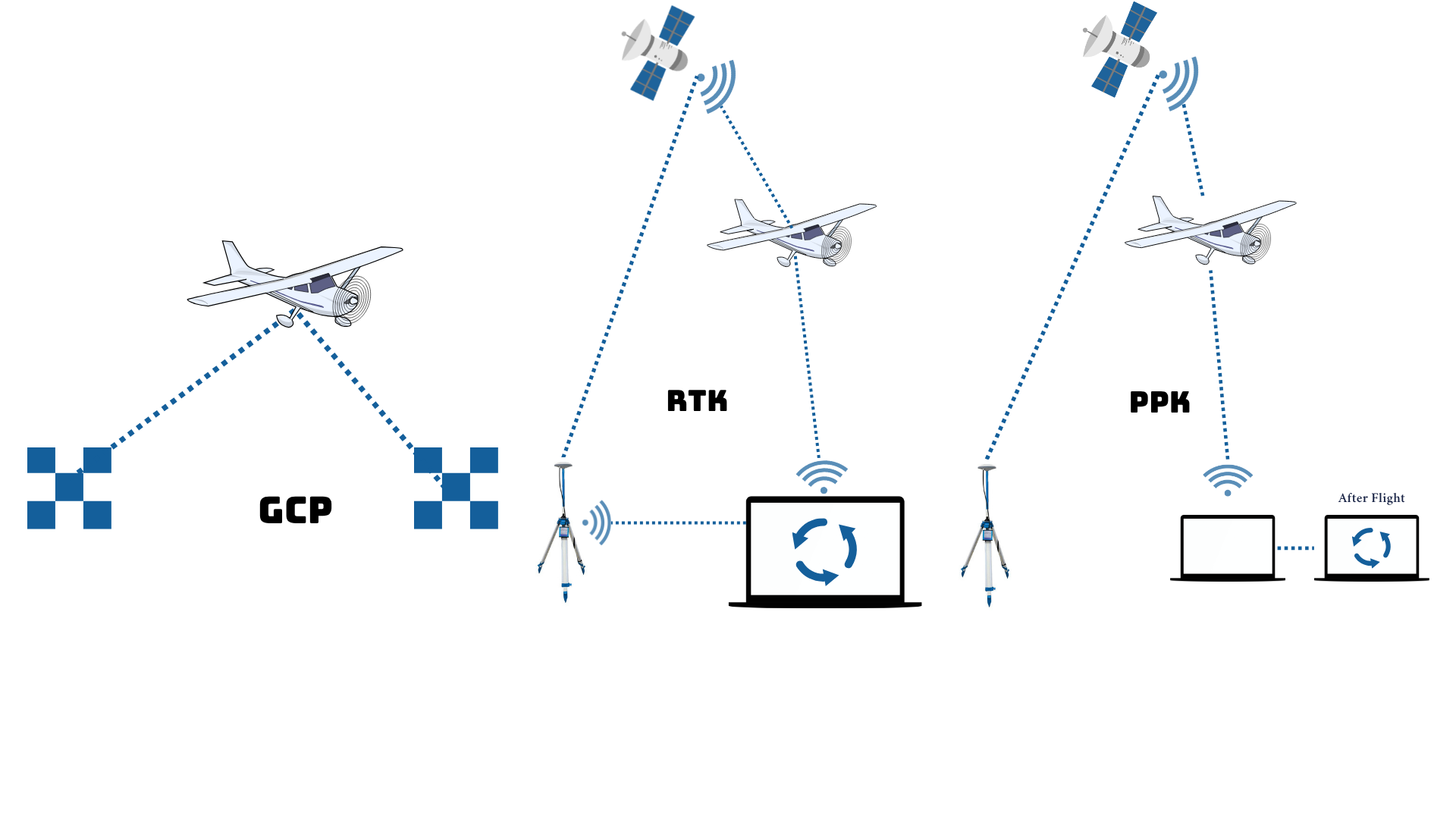
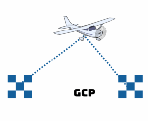
• GCP (Ground Control Point)
• RTK (Real-Time Kinematic)
• PPK (Post-Processing Kinematic).
GCPs, or Ground Control Points, are physical reference points in the field with known, high-precision geographic coordinates, usually marked with markers (premarks) clearly visible from the air. GCPs require the installation of control points to obtain their coordinates using GNSS measurements. A minimum of 3-5 GCPs are required per area for optimal results, depending on the size and complexity of the area.
RTK, or Real-Time Kinematic, is a real-time GNSS (Global Navigation Satellite System) data processing technique that uses a base station to correct satellite signals received by a drone. These corrections are received directly during flight via radio communication or the internet. RTK allows drones to record coordinates with high accuracy (around 1-2 cm) directly, reducing reliance on GCPs.
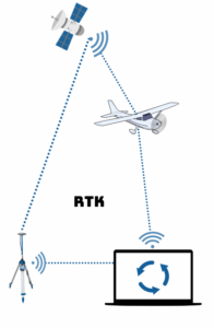
RTK, or Real-Time Kinematic, is a real-time GNSS (Global Navigation Satellite System) data processing technique that uses a base station to correct satellite signals received by a drone. These corrections are received directly during flight via radio communication or the internet. RTK allows drones to record coordinates with high accuracy (around 1-2 cm) directly, reducing reliance on GCPs.
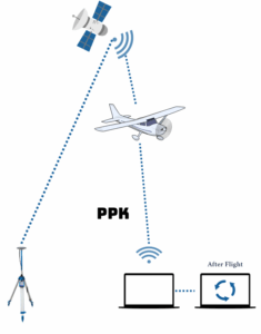
PPK, or Post-Processed Kinematics, is a method of processing GNSS data after a flight, where data from the drone (rover) and the base station are combined to correct the position. This process utilizes satellite data logs recorded during the flight. PPK provides high accuracy (1-3 cm) without the need for real-time communication.
These three methods each have their own advantages and disadvantages, depending on the conditions of the measurement location.
Use GCPs if you have the human resources and GNSS measurement equipment and want good results with manual control, but they are less suitable for difficult and enclosed terrain.
Use RTK for fast-paced projects with supporting network infrastructure, especially in areas with easy signal coverage.
Use PPK for remote or complex areas, with the advantage of flexibility without a direct connection in the field.