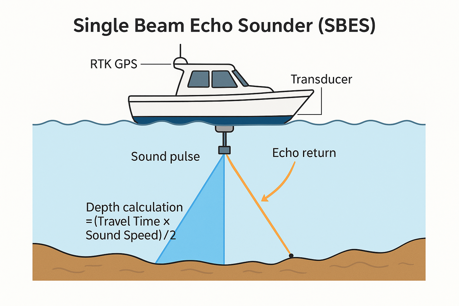
Single Beam Echo Sounder (SBES) merupakan teknologi survei batimetri yang memanfaatkan pantulan gelombang suara untuk mengukur kedalaman secara vertikal dengan cepat dan akurat. Alat ini bersifat sederhana, ekonomis, dan sangat efektif digunakan pada perairan dangkal seperti sungai, kanal, dan rawa.
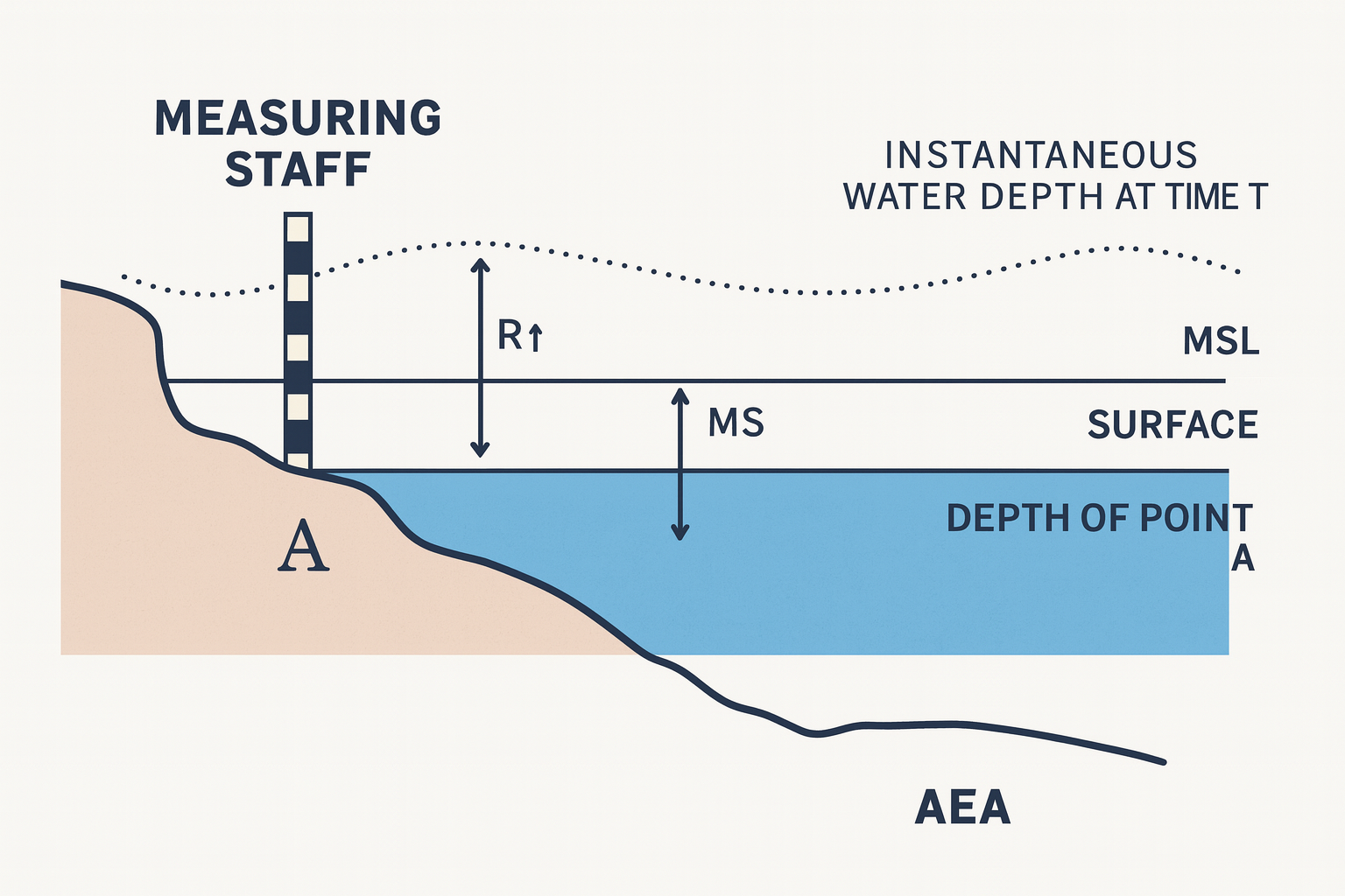
Meskipun hanya menghasilkan data pada satu jalur lintasan, SBES tetap menjadi instrumen penting karena hasil pengukurannya dapat dikoreksi terhadap pasang surut dan diintegrasikan dengan GPS/RTK, sehingga menghasilkan data kedalaman yang konsisten dan andal untuk mendukung kebutuhan navigasi, pemetaan, serta perencanaan infrastruktur perairan.