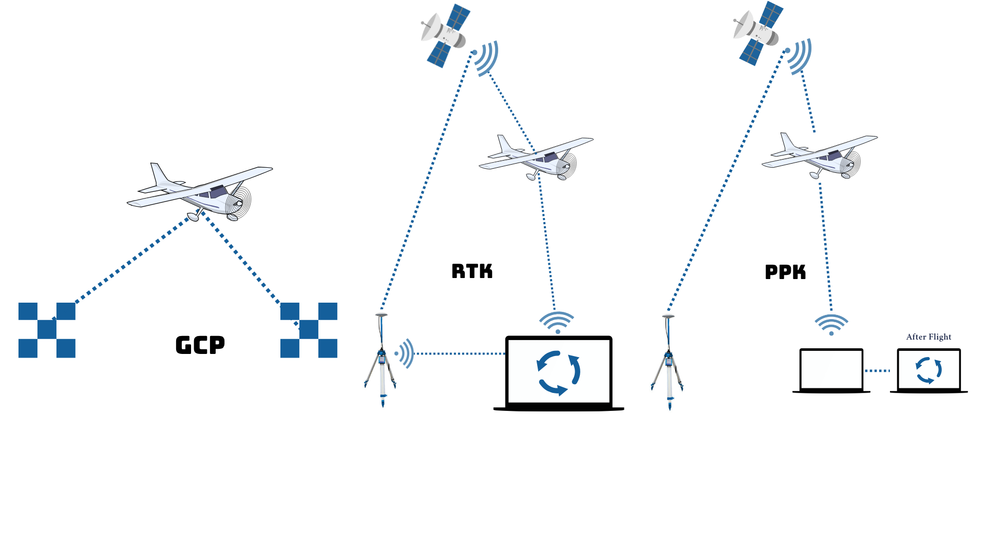
Precision Navigation on Drone Mapping is a high-precision navigation technology used to ensure drones fly accurately on planned paths and positions. With the support of GNSS RTK/PPK systems and other navigation sensors, drones can record the position of each aerial image with centimeter accuracy. This technology is crucial in professional mapping because it produces precise data with minimal distortion, allowing output such as orthophotos, contour maps, and digital elevation models to be directly used for technical needs such as infrastructure planning, engineering design, or spatial analysis. Precision navigation ensures drone mapping is not only fast and efficient, but also highly accurate.