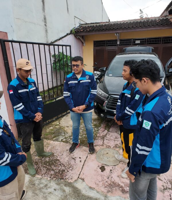
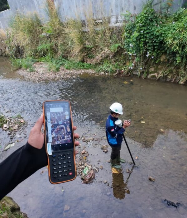
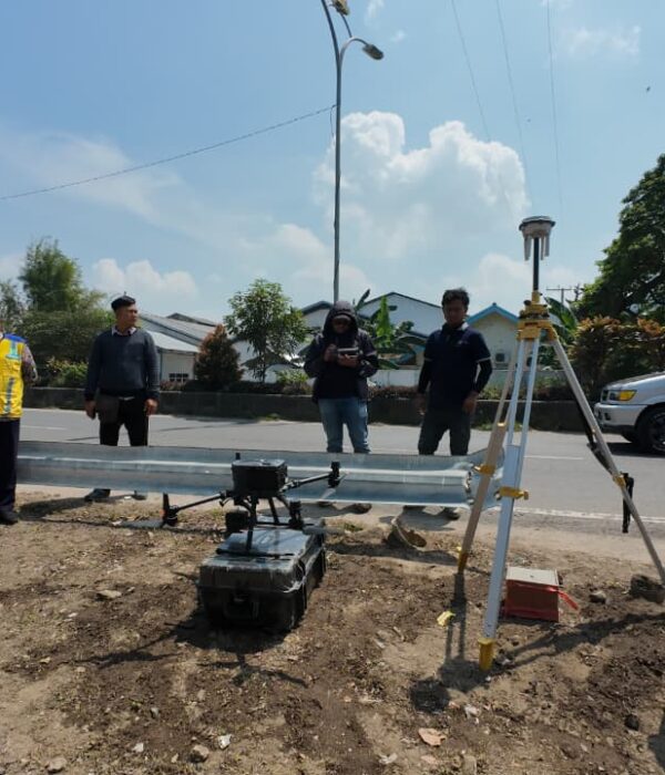
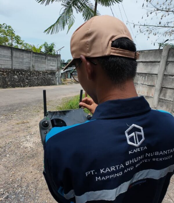
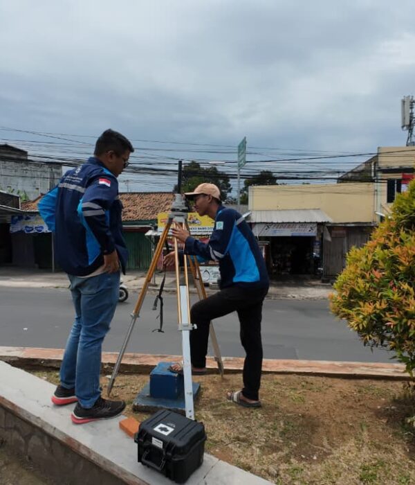
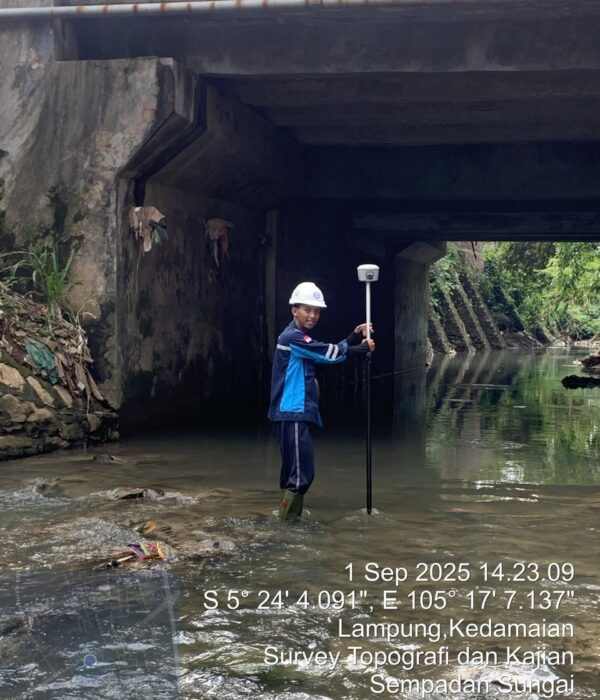
Topographic Survey for the Way Garuntang and Way Balau River Boundaries, Lampung

Project Details

PT Karta Bhumi Nusantara and its team have completed a topographic survey of the Way Garuntang and Way Balau Rivers in Bandar Lampung City, Lampung Province. This survey was conducted using UAV LiDAR for detailed elevation mapping and GNSS RTK for determining ground control points and validating data accuracy.

Project Name
Topographic Survey for the Way Garuntang and Way Balau River Boundaries, Lampung
Category
Planning

Project Summery

Topographic Survey for the Way Garuntang and Way Balau River Boundaries, Lampung
PT Karta Bhumi Nusantara, along with its implementing team, successfully completed a topographic survey of the Way Garuntang and Way Balau River boundaries in Bandar Lampung City, Lampung Province. This survey was conducted to obtain high-precision spatial data that can be used as a basis for determining river boundaries along approximately 26.9 km. Given the river's location across an urban area with a relatively high population density, this survey plays a crucial role in the development of spatial planning policies, flood control, and the protection of protected areas along the riverbanks.
The methodology applied in this survey utilized UAV LiDAR technology for detailed elevation data acquisition and GNSS RTK for ground control point (GCP) measurements, which serve to bind and validate the LiDAR data. The combination of these two methods resulted in the acquisition of precise topographic data, both in the form of 0.5-meter interval contours and digital surface models (DSMs) and digital elevation models (DEMs). The advantage of UAV LiDAR is that it allows for dense vegetation penetration along riverbanks, allowing for a clearer understanding of the underlying morphology of the land.
The mapping scope not only focuses on the main river channel but also includes the banks on both sides of the river, which are included in the riparian area. The data obtained is used to produce detailed topographic maps, cross-sections at specific intervals, and long sections along the river alignment. This information is crucial for identifying changes in river channel geometry, potential erosion, critical landslide points, and areas prone to flooding. Thus, the survey results provide a comprehensive picture of the existing condition of the river and surrounding land.
The main problem faced in this area is the high pressure of human activities along the riverbanks, ranging from settlements and economic activities to waste disposal. This often leads to flooding, siltation, and reduced environmental quality. With this survey data, the local government and relevant technical agencies have a strong basis for establishing riparian lines in accordance with regulations and developing disaster mitigation programs based on current data.
In addition to technical and environmental aspects, the survey results also contribute to the development of regional medium-term development planning documents (RPJMD), detailed spatial planning plans (RDTR), and flood control master plans in the Bandar Lampung urban area.
With UAV LiDAR and GNSS RTK technology-based solutions, PT Karta Bhumi Nusantara is able to provide accurate, fast, and comprehensive data to support the needs of both the government and the private sector in river management. This work not only produces maps and topographic models but also serves as a crucial instrument in efforts to maintain ecological balance and sustainable development in the Lampung urban area. With valid data, it is hoped that decision-making can be more targeted, effective, and oriented towards environmental sustainability.
#LiDAR #UAVLiDAR #Photogrammetry #PointCloud #GeoSpatial #3DMapping #DroneMapping #Surveying #Mapping #Topography #Consultant #SpatialData #GNSSRTK #GpsGeodetic #MappingConsultant #GIS #GISAnalysis #Forestry #topoghrapicmapping #LongandCrossSection #Countur #MappingSpasial