Project Details
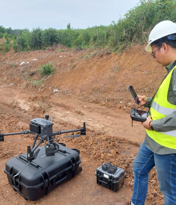
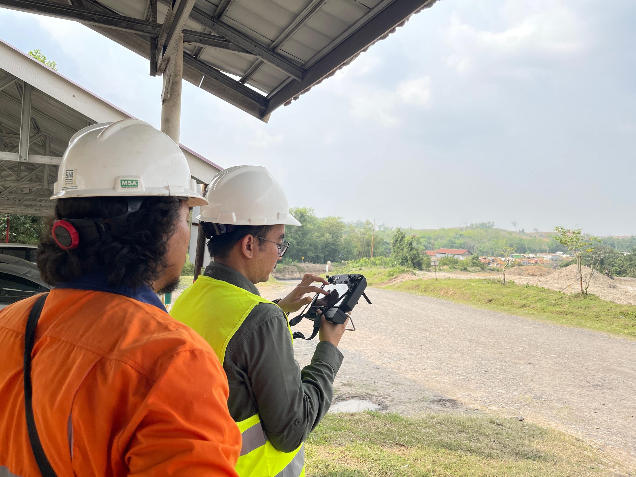
PT Karta Bhumi Nusantara and its team have completed a topographic survey using UAV LiDAR, photogrammetry, and bathymetry in the Muara Enim area of South Sumatra. This activity encompassed mapping approximately 89 hectares of land and approximately 22.5 hectares of river bodies, including the Bangke River, Mbiung River, and Kiahaan River. The survey was conducted to support technical planning, hydrological analysis, and environmental management in the mining concession area.
Project Summary
PT Karta Bhumi Nusantara telah menyelesaikan survei topografi terpadu menggunakan UAV LiDAR, fotogrametri, dan batimetri di wilayah konsesi PT Manambang Muara Enim di Sumatera Selatan. Kegiatan ini berfokus pada tiga sungai utama: Sungai Bangke, Sungai Mbiung, dan Sungai Kiahaan, yang memiliki karakteristik morfologi kompleks, menggabungkan lahan terbuka, vegetasi padat, dan badan sungai dengan kedalaman yang bervariasi.
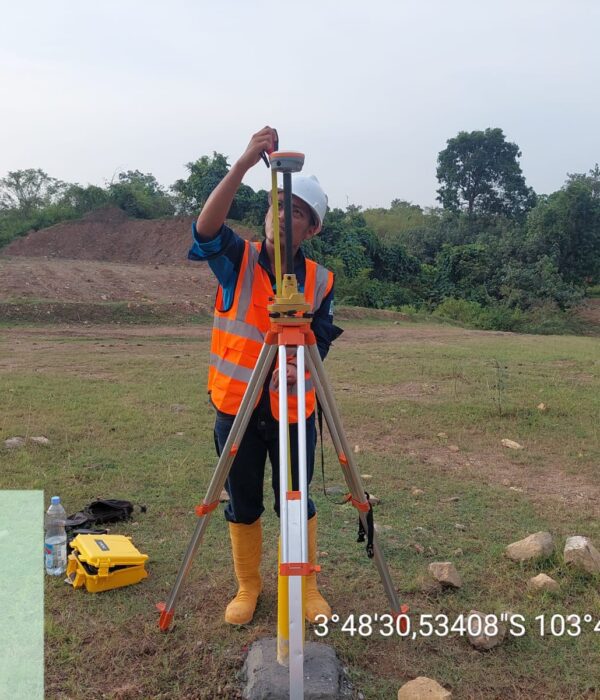
Pemantauan dilakukan di area daratan seluas sekitar 89 hektar dan badan sungai seluas sekitar 22,5 hektar. Untuk memperoleh data yang akurat, tim memasang titik kontrol (CP) menggunakan metode GNSS statis, diikuti dengan pengumpulan data UAV LiDAR dan fotogrametri. Hasil pemetaan menghasilkan foto udara ortofoto beresolusi tinggi dengan akurasi 2 cm per piksel, serta awan titik LiDAR, yang kemudian diklasifikasikan menjadi objek tanah, vegetasi, dan objek lain.
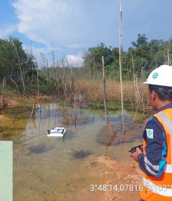
Selain itu, survei batimetri menggunakan USV yang dilengkapi dengan sensor Garmin 585 Plus Single Beam Echo Sounder (SBES) dilakukan di Sungai Mbiung dan Kiahaan, sementara metode RTK GNSS digunakan di Sungai Bangke. Hasilnya adalah model elevasi dasar sungai, peta batimetri, dan profil longitudinal serta transversal yang memberikan rincian tentang kedalaman, lebar, dan kondisi tepi sungai.
Hasil keluaran yang dihasilkan meliputi peta ortofoto, peta kontur 0,5 m, model elevasi digital, panjang dan penampang melintang, serta deskripsi koordinat wilayah tangkapan air. Semua data ini telah diintegrasikan ke dalam sistem koordinat resmi, memungkinkan penggunaan langsung untuk mendukung perencanaan teknis dan pemodelan hidrologi.
Hasil survei juga mengungkapkan perubahan signifikan pada lanskap dari tahun 2013 hingga 2024, terutama akibat aktivitas pertambangan terbuka di sekitar Sungai Bangke dan Mbiung. Perubahan ini mempengaruhi tutupan vegetasi, potensi sedimentasi, dan pola hidrologi sungai, menjadikan data spasial yang diperbarui ini krusial untuk perencanaan dan mitigasi dampak lingkungan.
Dengan memanfaatkan teknologi UAV LiDAR, RTK GNSS, dan USV Bathymetry, PT Karta Bhumi Nusantara terus menyediakan solusi survei modern yang akurat, efisien, dan berkelanjutan. Data yang dihasilkan menjadi landasan kritis untuk mendukung pengelolaan sumber daya udara, mitigasi risiko, dan pengembangan infrastruktur yang ramah lingkungan di wilayah Muara Enim.
#LiDAR #UAVLiDAR #Fotogrametri #PointCloud #GeoSpatial #3DMapping #DroneMapping #Survei #Pemetaan #Topografi #Konsultan #DataSpatial #KonsultanPemetaan #GIS #AnalisisGIS #Perhutanan #PemetaanPertambangan #LongandCrossSection #Kontur #PemetaanSpatial