Project Details
This report presents the results of a bathymetric survey in four rivers (Saragih, Sibundong, Pardomuan, and Husor) in Central Tapanuli (Tapanuli Tengah), North Sumatra, conducted in the aftermath of the November 2025 landslides and flash floods. The survey aimed to support post-disaster river mapping and management by providing high-resolution data on riverbed topography. An unmanned surface vehicle (USV) equipped with a single-beam echo sounder (SBES) and a GNSS Real-Time Kinematic (RTK) positioning system was used to acquire high-precision depth measurements. The resulting bathymetric dataset will serve as a baseline for assessing riverbed morphology changes and guiding rehabilitation planning in the affected area.
In November 2025, Central Tapanuli (Tapanuli Tengah) in North Sumatra was struck by severe landslides and flash flooding. These events caused significant damage to bridges and dramatically altered river channels through heavy sedimentation and erosion. To understand these changes, a specialized survey was launched using an Unmanned Surface Vehicle (USV) combined with high-precision GPS (GNSS RTK). The goal was to collect detailed river depth and topography data in the affected rivers (Saragih, Sibundong, Pardomuan, and Husor) and turn it into useful maps and models. This new spatial dataset – including bathymetric maps, contour maps, and a Digital Terrain Model (DTM) – provides a critical technical baseline for evaluating river conditions and supporting bridge rehabilitation and sustainable planning in the region.
Survey Area: Four Key Rivers
Survey Methods and Workflow
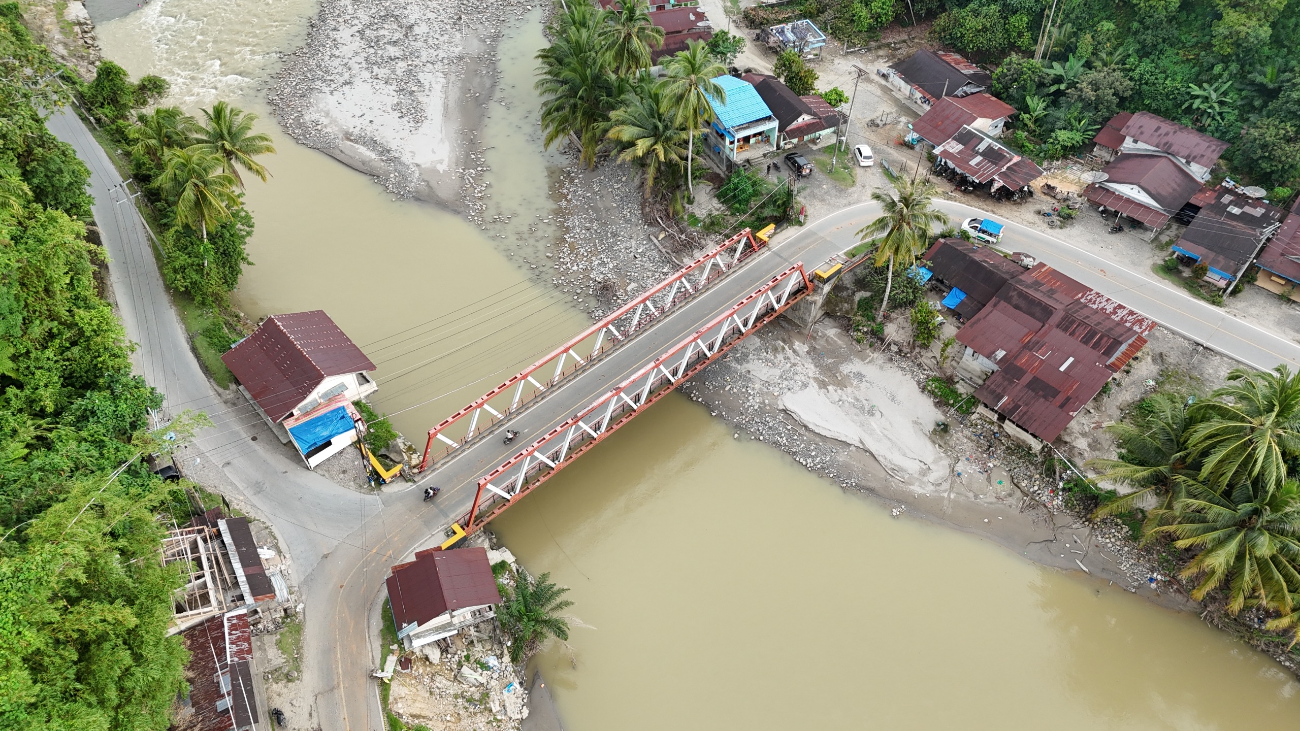
The survey covered four major river reaches in Tapanuli Tengah, each at a key bridge location. These included the Saragih River under the Saragih Bridge, the Sibundong (Aek Siborgung) River, the Pardomuan River, and the Husor (Aek Sirahar) River. By focusing on these strategic sites, the team could quickly assess where sediment had built up or scoured out after the disaster. The mapping results would inform which bridges or channels might need immediate attention, and also establish a detailed record of post-flood river geometry.
The project followed a systematic workflow to gather and process the data:
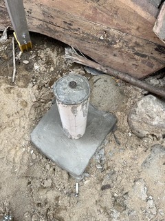
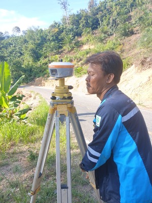
- Ground Control Points (CP): First, surveyors installed stable control points (CPs) on land around each river site. Each CP is a fixed benchmark (a painted PVC pole set in concrete) whose precise coordinates were measured by static GNSS surveying. These ground control points serve as reference stations (base points) for all subsequent measurements, ensuring that every depth and position reading ties back to a known coordinate system.
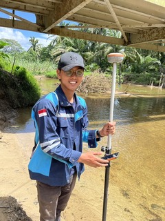
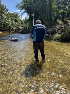
- GNSS RTK Survey: The team used GNSS receivers in Real-Time Kinematic (RTK) mode to capture water-level references and field positions. GNSS RTK provides centimeter-level positioning accuracy by continuously receiving correction signals from a fixed base (one of the CPs) to a mobile rover unit. This real-time method lets the team quickly record accurate coordinates (latitude, longitude, elevation) for any point, such as the boat or the water surface, which is vital for tying the depth data into the map.
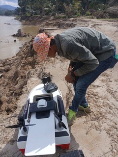
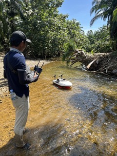
- USV Bathymetric Survey: A USV (unmanned surface vessel) – essentially a remote-controlled survey boat – was deployed along the river. This boat was equipped with a Single Beam Echo Sounder (SBES) (Garmin 585 Plus) to measure depth and with a GNSS receiver to track its location. The survey lines were planned as parallel or cross-sectional transects, spaced roughly 10–20 meters apart, adjusted for river width and desired detail. As the USV moved along each transect, it automatically logged depth (river bottom soundings) and position data at the same time. In other words, for every point the boat measured, we recorded its X (east), Y (north) and Z (depth) in one go.
- Data Processing: After fieldwork, the raw data went through processing to clean and correct it. Depth readings from the echo-sounder were adjusted for sensor calibration (transducer variations) and filtered to remove noise or spikes. The horizontal positions from the GNSS were also applied, yielding a corrected dataset of points with accurate X, Y and Z (easting, northing, elevation) values. These points (essentially thousands of (x, y, depth) measurements) formed the basis for building continuous models.
- Final Products: In the end, the survey produced a suite of deliverables: a detailed bathymetry map of each surveyed river reach, riverbed contour maps, and the DTM of the river bottom. All digital data (point clouds, models, coordinates) were organized into GIS-compatible formats. These maps and models allow engineers and planners to see exactly how the river channels changed due to the disaster, down to meter-scale detail.
Survey Results and Visualizations
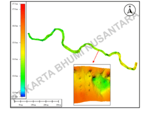
Example of a bathymetric map from the survey Saragih River. Colors indicate water depth, and the model is draped over an aerial photo. Such maps help identify deep pools (blue) or shallow, sediment-filled areas green.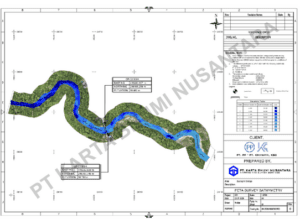
The results reveal how each river’s channel changed. For instance, the bathymetric maps (as shown above) highlight sections of scouring (dark blue, deeper zones) versus sediment accumulation (lighter colors). Similarly, the DTM (digital terrain model) provides a 3D view of the riverbed. The DTM below is a shaded relief of one river reach, making subtle depth variations visible:
In summary, the bathymetric survey provides a data-driven foundation for all recovery decisions. By combining traditional GNSS surveying (for control points and water levels) with an innovative USV-based sounding approach, the project quickly produced actionable maps and models. The end result – high-resolution DTM, bathymetry, and contour maps – will directly support the region’s bridge repair plans and ensure sustainable waterway management moving forward.
Let’s collaborate. Contact us to discuss your survey needs and get the right data from the start.
#Batimetri #SurveiHidrografi #GNSS #USV #PemulihanBanjir #PemulihanLongsor #TapanuliTengah #JasaSurveiPemetaan #JasaSureiBatimetri #JasaSurveiTopografi