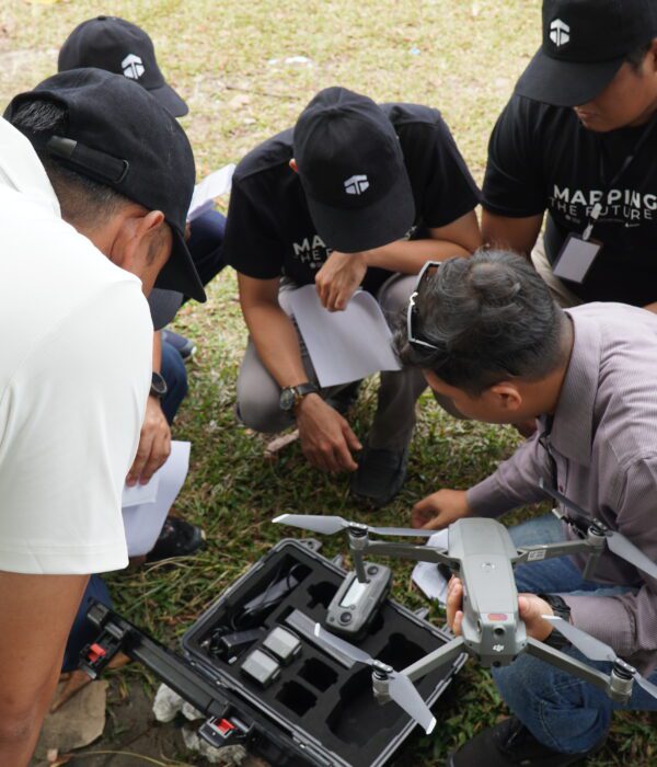
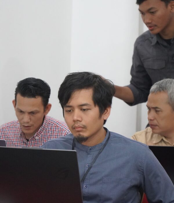
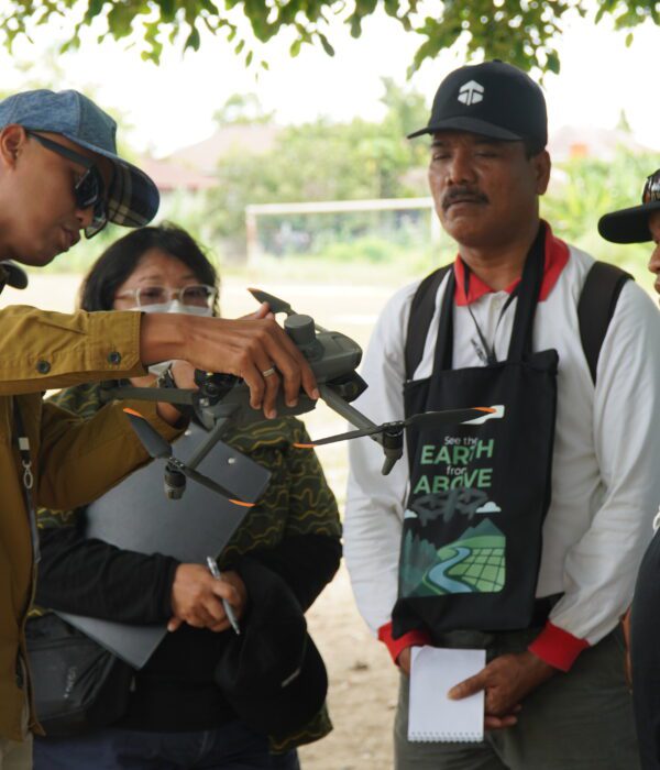
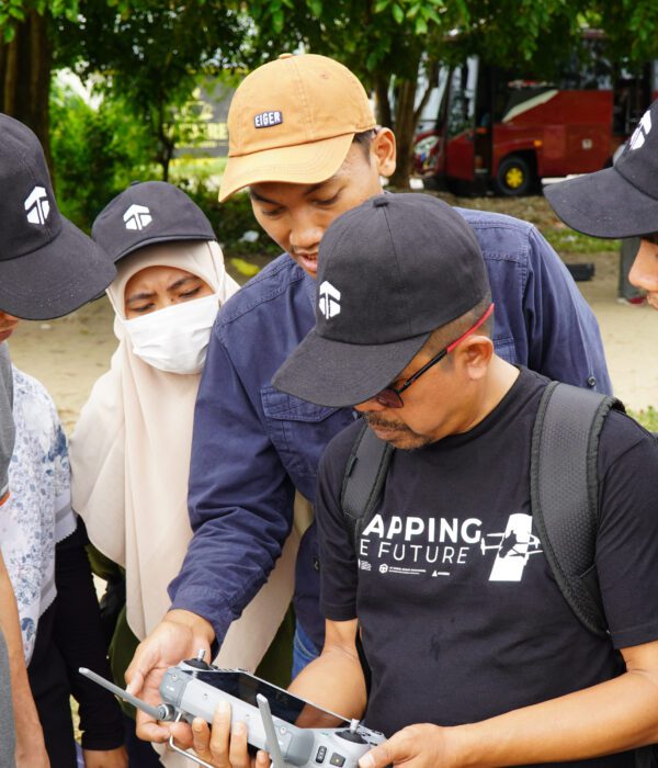
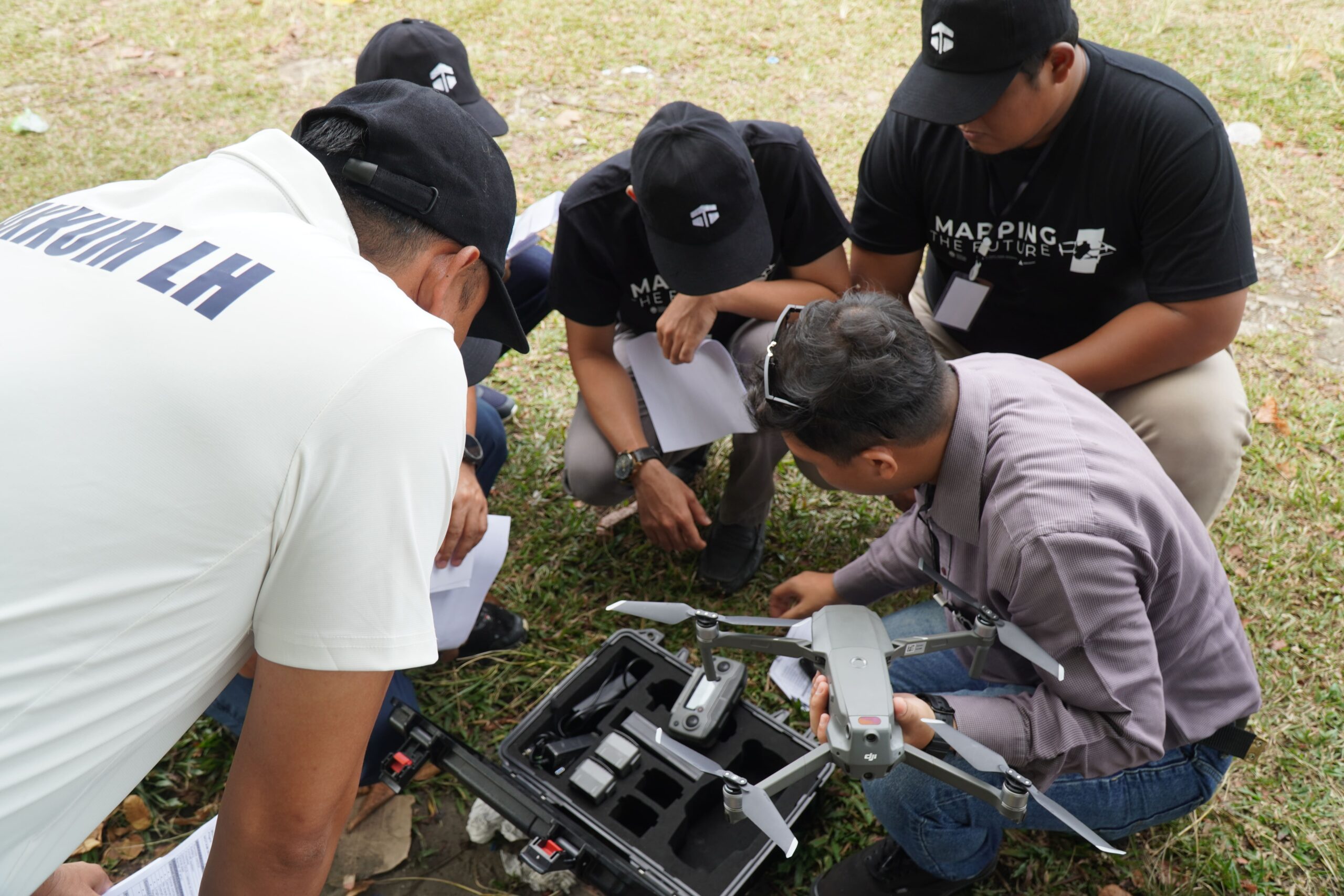
Project Details
In a strategic collaboration with the Ministry of Environment and Forestry (KLHK) and Artabhumi, our team of expert consultants provided comprehensive mentorship in advanced photogrammetry, high-precision GCP (Ground Control Point) deployment, and complex volumetric data analysis. This initiative was designed to empower ministry personnel with the spatial intelligence necessary for the sustainable management and real-time monitoring of Sumatra’s vital forest ecosystems.
Project Name
Advancing Environmental Monitoring: Karta Bhumi Nusantara & Artabhumi Empower KLHK with Drone Technology in Pekanbaru
Category
Planning
Project Summery
Pekanbaru, Sumatra – In an era where environmental data precision is paramount, Karta Bhumi Nusantara, a leading Spatial & Environmental Mapping Consultancy, successfully conducted an intensive technical training program for the Ministry of Environment and Forestry (KLHK) personnel.
In strategic partnership with Artabhumi, the program held in mid-November 2025 in Pekanbaru marks a significant milestone in integrating photogrammetry technology for the monitoring of forest areas and environmental conservation throughout the Sumatra region.
Karta Bhumi Nusantara: Beyond Training, We Deliver Consulting Excellence
As a specialized consultancy, Karta Bhumi Nusantara recognizes that aerial imagery is only as valuable as its accuracy. During this collaboration with KLHK, Karta Bhumi Nusantara implemented high-tier consulting standards, ensuring every participant could produce data that is both scientifically valid and legally accountable.
"Our mission extends beyond teaching drone flight; we provide a consulting methodology that transforms raw data into actionable spatial intelligence," stated the expert team from Karta Bhumi Nusantara.
Strategic Program Highlights: Professional Consulting Standards
The three-day curriculum was systematically designed to cover all operational and managerial aspects of modern mapping:
1. Theoretical Foundation & Legal Compliance (Day 1)
The session commenced with a deep dive into photogrammetry theory and the drone ecosystem for environmental use. As a law-abiding consultancy, Karta Bhumi Nusantara placed heavy emphasis on:
-UAV Regulations: Ensuring all KLHK drone operations comply with Indonesian airspace authorities.
-Safety Management: Implementing Work Health and Safety (WHS/K3) protocols to mitigate field risks..
-Flight Planning: Strategic mission planning for efficient data acquisition over vast terrains.
2. Field Implementation & GCP Precision (Day 2)
Theory was put into practice as participants mobilized to the field. Under the guidance of Artabhumi instructors and Karta Bhumi consultants, participants executed:
-GCP (Ground Control Point) Deployment: A crucial consulting technique emphasized by Karta Bhumi to ensure high-precision georeferencing.
-Pre-flight & Emergency Procedures: Establishing SOPs to safeguard high-value hardware assets.
-Data Acquisition: Capturing high-resolution aerial data optimized for advanced processing.
3. Advanced Data Processing & Volumetric Analysis (Day 3)
The final stage showcased Karta Bhumi Nusantara’s core expertise in data analytics. Participants were mentored in:
-Orthophoto Processing: Converting raw images into detailed, measurable digital maps.
-Volumetric Analysis: Calculating stockpile volumes and land changes with high precision.
-Visualization & Reporting: Communicating spatial data effectively to support KLHK’s policy-making.
Does your agency or company require accurate and professional mapping solutions? Karta Bhumi Nusantara is ready to be your strategic partner in providing mapping consultancy and drone training across Indonesia.
#KartaBhumiNusantara #MappingConsultant #EnvironmentalConsultancy #DroneSurvey #Photogrammetry #SpatialIntelligence #KLHK #PekanbaruProject #UAVMapping #GeospatialSolutions #ForestryMonitoring #VolumetricAnalysis #JasaSurveiLiDAR